Geotrek-rando
EN
FR
EN
Search
Menu
Filters
1
Practice
Practice
Walking hike
Mountain bike (electric)
Trail
Difficulty
Very easy
Easy
Difficult
Challenging
Duration
0 - 1h
1h - 2h
2h - 5h
5h - 10h
Length
0 - 5km
5km - 10km
10km - 15km
15km - 50km
Ascent
0 - 500m
500m - 1000m
> 1000m
Type
Loop
Return
Crossing
Trekking
Accessibility
Wheelchair
Pushchair
Joëlette
Others
Is in the midst of the park
Themes
Themes
Fauna
Flora
Viewpoint
Architecture
Pastoralism
Geology
Lake and glacier
Summit
Refuge
History
28
Localization
Localization
District
Arves
Beaufortain
Belledonne
Lauzière
Maurienne
Mont-cenis
Parc national de la Vanoise
Tarentaise
Thabor
Vanoise
AIGUEBLANCHE
AIME-LA-PLAGNE
BOURG-SAINT-MAURICE
BOZEL
BRIDES-LES-BAINS
CHAMPAGNY-EN-VANOISE
FEISSONS-SUR-SALINS
HAUTECOUR
LA LECHERE
LA PLAGNE TARENTAISE
LANDRY
LES ALLUES
LES AVANCHERS-VALMOREL
LES BELLEVILLE
LES CHAPELLES
MONTAGNY
MONTVALEZAN
MOUTIERS
NOTRE-DAME-DU-PRE
PEISEY-NANCROIX
PRALOGNAN-LA-VANOISE
SAINT-MARCEL
SAINTE-FOY-TARENTAISE
SALINS-FONTAINE
SEEZ
TIGNES
VAL D'ISERE
VILLAROGER
Clear all
47 results
47 results found
29
Filter
Search
Search
Display Map
ccva
Walking hike
LA LECHERE
Flora
Pastoralism
Viewpoint
Difficult
5h30
10,3km
+800m
Walking hike
VAL D'ISERE
Challenging
5j
60,9km
+4332m
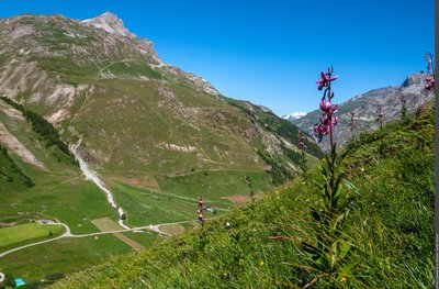
Le torrent du Morel - La Communauté de Communes Des Vallées d'Aigueblanche
Walking hike
AIGUEBLANCHE
Along the water (B23)
Architecture
History
Viewpoint
Easy
4h
11,8km
+330m
Sur le sentier des zones humides de Burdin - Céline RUTTEN
Walking hike
LES BELLEVILLE
Burdin Wetland Trail
Fauna
History
Very easy
1h
1,7km
+24m
Le Lac de la Bailletta devant la Pointe de la Bailletta - BOUCHE Michel
Walking hike
VAL D'ISERE
Col de la Bailletta from le Fornet
Fauna
Flora
Viewpoint
Easy
6h30
17,1km
+1360m
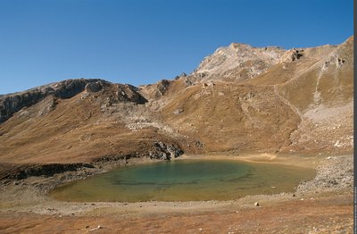
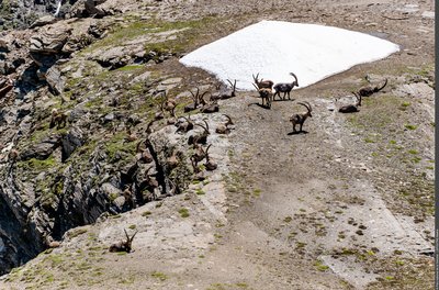
Harde de bouquetins au Col de la Lose - Maëlle LEPOUTRE
Walking hike
VAL D'ISERE
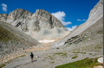
Col de la Lose
Fauna
Geology
Viewpoint
Easy
5h30
11,8km
+941m
Lis martagon - Vallon du Manchet, commune de Val-d'Isère - AUGÉ Vincent
Walking hike
VAL D'ISERE
Col des Fours from Manchet
Fauna
Flora
Viewpoint
Difficult
6h
13,1km
+1066m
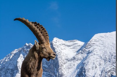
Bouquetin des Alpes mâle près du hameau du Laisonnay d'En Haut - Christophe GOTTI
Walking hike
CHAMPAGNY-EN-VANOISE
Col du Palet from Laisonnay
Geology
Lake and glacier
Summit
Difficult
8h
22,1km
+1157m
En direction du Col du Soufre - Isabelle MIRA
Walking hike
LES ALLUES
Col du Soufre
Lake and glacier
Difficult
9h
23,3km
+1173m
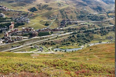
Le hameau des Bruyères et son plan d'eau - STORCK Frantz
Walking hike
LES BELLEVILLE
Family walk around the Plan de l'Eau des Bruyères
Fauna
Flora
Very easy
1h30
2,8km
+32m
Next page
Loading