
Col du Palet from Laisonnay
Description
- Departure : Car park, Laisonnay d'en bas, Champagny-en-Vanoise
- Arrival : Car park, Laisonnay d'en bas, Champagny-en-Vanoise
- Towns crossed : CHAMPAGNY-EN-VANOISE and PEISEY-NANCROIX
Forecast
Altimetric profile
Recommandations
Information desks
Maison de la Vanoise, Avenue Chasseforêt, 73710 Pralognan-la-Vanoise
Tourist Information Office - Champagny en Vanoise
Le Centre, 73350 Champagny-en-Vanoise
Public transportation
Then transport by coach to Champagny le Bas. Information: www.transavoie.com.
Transport by taxi is still possible to Laisonnay d´en bas.
Also think about car-sharing with www.mobisavoie.fr"
Access and parking
Parking :
Route planner
More information
10 points of interest
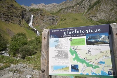
Le sentier glaciologique - Gouedard  Glacier
Glacier Trail
Take in the valley’s true magnificence from the Palet Pass, which provides you with views of some of the massif’s highest glaciers, with eight numbered marker posts located along the trail by the Vanoise National Park.
The itinerary, which takes around 4 hours to complete, was created and waymarked by the Vanoise National Park. The accompanying booklet contains all the information you might need as you get better acquainted with mountain glaciers.
On the itinerary: the Glière mountain hut (restaurant service and beds for the night), the high mountain pastures of the Plan du Sel and the secrets of Beaufort cheese production, and above all, no end of marmots!
You can get a copy of the booklet at the Laisonnay Reception and Information Point.
Hameau du Laisonnay - OTGP  History
Hamlet of Laisonnay
Laisonnay is the oldest and most remote hamlet. It was here that the first inhabitants (of Haute-Tarentaise) settled, after crossing the Palet Pass into the valley. It contains a dozen or so stone buildings with traditional stone slate and wooden shingle roofs and a renovated with smattering of more recent materials. Houses are grouped together in order to make use of the few locations not exposed to natural risks (avalanches, rock falls and flooding by the Doron). Notre Dame des Neiges Chapel downstream of the hamlet and the old oven upstream are both well worth a visit.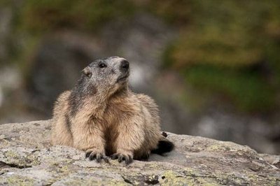
Marmotte prenant un bain de soleil sur un rocher. - PNV - HERRMANN Mylène  Fauna
FaunaThe marmot
An iconic animal of the alpine grasslands, the marmot is closely related to the squirrel, with 4 digits on the front paws and 5 digits on the back paws. The marmot lives on a family territory that the dominant adults defend tooth and claw. The marmot hibernates and lives idly for 6 months on its reserves of fat accumulated during the summer. The marmot is present throughout the entire route, but especially around the chapel of La Glière.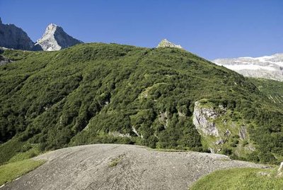
Le "Dos de l'éléphant" : roche polie et striée par le passage du glacier. - PNV - GOTTI Christophe  Geology
Dos de l'éléphant (1,850 m)
"A mica schist outcrop polished and striated by the passage of quaternary glaciers, the last great ice age gœs back more than 10,000 years. The glaciers descended to Lyon at that time, and ice over 1,000 m in thickness filled the great valleys (Grenoble). The English call these “roches moutonnées” whalebacks. The inhabitants of Champagny-en-Vanoise call this rock ""Dos de l´éléphant” (the elephant’s back)."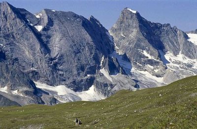
L'Aiguille de l'Epéna, les Pointes de l'Epéna et de la grande Glière. - PNV - BALAIS Christian GeologyMountain forms and rock
The shape of the mountains depends on its natural surroundings, particularly on the hardness of the rock. The Grand Bec and the Pointe des Volnets are comprised of mica schist. The Aiguille de la Grande Glière, nicknamed the Matterhorn of Vanoise is comprised of very hard quartzite. The Épéna - the highest limestone cliff in France, with a vertical drop of 800 m - has a very sharp but very disintegrated summit ridge. The Grande Casse, comprised of black schistous limestone, has a highly ravined sloping north side.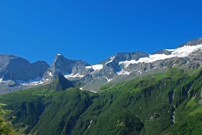
Forêt d'aulnes verts - OTGP  Flora
FloraGreen alder forest
On the ubac slope (i.e. the slope with the shortest exposure to sunlight), little waterfalls sourced by glaciers help maintain a forest of green alders, known locally as “arcosses”, which grow in damp, shaded environments. Their supple arched branches reach downstream while their roots are anchored upstream. In avalanche corridors they can therefore bend under the weight of the snow and then right themselves without suffering damage. This “primary” forest, so called as it has existed since the end of the Ice Age, covers almost eight kilometres and is one of the largest in Europe.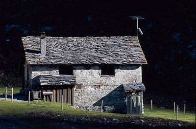
Le refuge communal de la Glière. - PNV - GOTTI Christophe  Pastoralism
The Refuge Communal de la Glière (1,996m).
Formerly an alpine chalet, with 2 cellars nearby, the Refuge de la Glière was extended in 2014 to provide greater comfort to more hikers and climbers. It is also accessible to wheel-chair users who sometimes come by the Joëlette. It is kept from mid-June to mid-September. The winter refuge is also open the rest of the year and the visitor is obliged to pay his passage fee in the collection box provided for this purpose. In return the visitor will find blankets, gas and dishes and a stove with firewood. Show respect for this refuge and don’t forget to pay your fee which pays for its upkeep.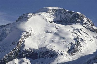
La Grande Motte, Champagny en Vanoise. - PNV - BENOÎT Philippe GlacierThe Grande Motte (3,653m)
A magnificent glacial dome, visible from the valley of Champagny le Haut, the Grande Motte looms over the ski resort of Tignes. The Grande Motte cable car (3,450 m) serves the glacier of the same name, still used for summer skiing. This cable car’s pylon, visible along the length of the hike, is located in the municipal territory of Champagny-en-Vanoise. The STGM (Compagnie des Téléphériques de la Grande Motte) pays a fee each year to the town of Champagny-en-Vanoise.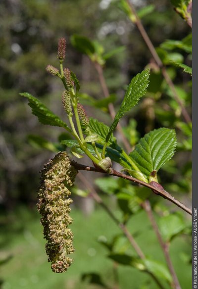
l'aulne vert - Vincent AUGE FloraThe green alder
The green alder, called locally as the arcosse, grows on the ubac (north facing slope) of the valley, as it prefers cooler environments. This shrub has the peculiarity of bending under the weight of the snow without breaking. It can therefore grow even in avalanche paths. The green alder between the hamlet of Bois and the Épéna glacier is the largest green alder in Europe at 7 km long. Green alder wood was once used for baking Beaufort.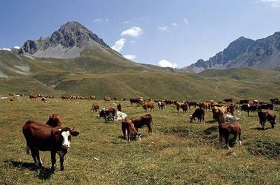
Troupeau de vaches de races Tarentaise et Abondance. - PNV - GARNIER Alexandre PastoralismThe mountain pasture of Grande Plagne
The alpine farmers lead the cows every year on to the mountain pastures of the Grande Plagne. At the chalet of Plan du Salt (2,250 m), the milk of the tarentaise and abondance cows (the only breeds authorised under the Beaufort PDO) is transformed into Beaufort d´Alpage over 100 days. The weak spot of this mountain pasture is the water resource. During periods of drought, the alpine farmer must obtain supplies downstream from the Refuge de la Glière, and pay for a number of trips to take up one tonne of water to the chalet.