
Col de la Lose
"
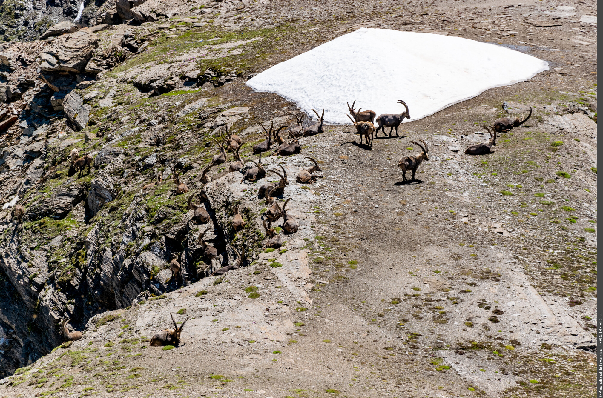
Lovely hike up the Isère, through the plateau de Prariond and a view over the glaciers of the Isère springs. Hiking is best appreciated during the ""Indian summer"" under the lights and colours of late summer, and perhaps the chance to run into the lord of the place - the alpine ibex.
"
Description
Park at the Pont Saint-Charles car park. Follow the single trail via the gorges of Malpasset, which leads to the Prariond plateau and its refuge at the end. Take the trail that winds up above the refuge to the sloping ledge of the Grande Tête. Follow the cairns that lead to the crossroads of the paths between the Col de la Galise and the Col de la Lose. Take the trail on the right. From this moment the trail is less visible and may be cut by névés. The pass will be indicated by a reading table and a Vanoise National Park signpost. To return, take the route in the opposite direction.
- Departure : Pont Saint-Charles car park, Val d'Isère
- Arrival : ont Saint-Charles car park, Val d'Isère
- Towns crossed : VAL D'ISERE
Forecast
Altimetric profile
Sensitive areas
Alpine ibex - winter
- Impacted practices:
- Aerial, Land, Vertical
- Sensitivity periods:
- JanFebMarDec
- Contact:
Parc national de la Vanoise - Elodie Antoine -
elodie.antoine@vanoise-parcnational.fr
04 79 06 03 15
Recommandations
"
Despite a ""wide"" mountain trail (0.70 to 1 m in width) and the presence of 3 handrails, the crossing of the Malpasset gorges has a ""steep incline"" for about 1 km. Be extra vigilant with young children or people prone to vertigo. The use of some reins for children may be reassuring for everyone.
"
Public transportation
"
"
Access and parking
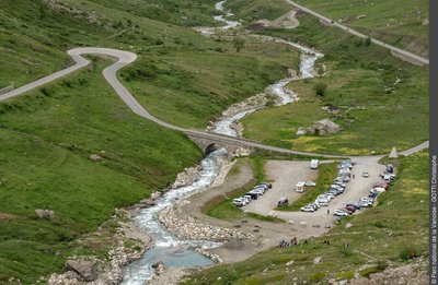
From the Tourist Information Office of Val d´Isère follow the RD 902, in the direction of the Col de l´Iseran. Cross the hamlet of Fornet. Walk for approximately 3 km. Before crossing the Isère river, enter the Pont Saint-Charles car park on the left of the road. It is indicated by a large built cairn.
Parking :
Route planner
More information
10 points of interest
Source du Pont Saint-Charles - Christophe GOTTI  Water
WaterThe water intake of Pont Saint-Charles
"This ""basin"" is one of the inlets of Val d´Isère. This mainly supplies water to the 30,000 weekly visitors that the resort receives each winter. The water from the catchment area is used for drinking water, the residents’ sanitation needs, the municipality’s public facilities and also for the manufacture of part of the artificial snow of the ski slopes. Like all ski resorts, these winter collections coincide with the low water period, when the flow rate is the lowest."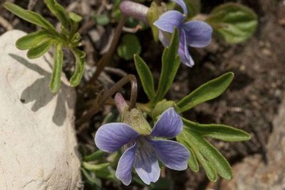
Violette à feuilles pennées. - PNV - GOTTI Christophe  Flora
FloraThe viola pinnata
"The term ""pinnata"" applied to this violet (Viola pinnata) refers to the deeply-cut lobe shape leaves, a feature that is only observed in this species in Vanoise. It grows on scorched grasslands, clear forests rocks, preferably on limestone, gypsum and on well-exposed slopes (south, south-east). In France, it is listed in just four alpine departments from Savoy to the Alpes-Maritimes. The Savoyard towns are limited to five Tarentaise municipalities. Historical records are still to be found in Maurienne. It’s in the valley of Prariond that the highest known populations live at 2,610 metres in altitude! Its rarity justifies its protection nationwide."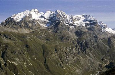
Vue sur la Tsanteleina, les Pointes du Couart dessus, la Pointe de Bazel, la Pointe de Calabre. - PNV - BALAIS Christian  Geology
The mudslide of Rouvines de Bazel
The stream that you cross is the Rouvines de Bazel. In 2011, during a storm, the stream turned into a torrential wash. The thalweg was embanked several metres and a mudslide flowed down to Isère (still visible). This geological incident led to the trail being moved by National Park workers. The mountain is constantly evolving and often cataclysmically! The étagnes (female ibex) subsequently made the most of this incident by exploiting the natural salt water on the mudslide.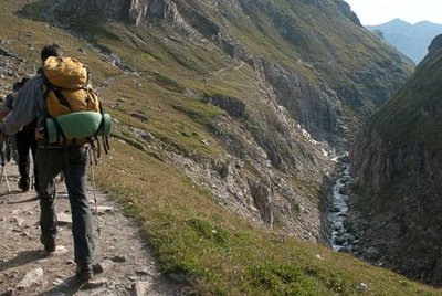
Vue sur les Gorges du Malpasset (à dr.). Commune de Val d’Isère. - PNV - NEUMÜLLER Christian GeologyThe gorges of Malpasset
"In the last 2 million years, the glaciers have eroded the valleys by giving them a typical ""U"" shape. The valley of Isère is a fine local example. By contrast, when the rocks are harder, glacial rock bars are formed, such as the gorges of Malpasset or those of the Daille. It is then that the erosion of the stream below and upstream of the glacier takes over. The cliff screes of the rock bar end up accentuating this embankment."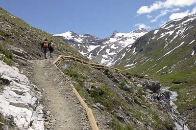
Réfection et stabilisation de la plate-forme du sentier par la technique des gabions en rondins de mélèze. - PNV - ROULAND Patrick GeologyThe Alps are moving!
The gorges also show the traces of the uplift of the Alps. Following the collision between the Eurasian and African continental plates, the limestone and schistous layers became folded like marshmallows. Ÿou then begin to understand the colossal energies in action! This phenomenon is still ongoing. Proof can be seen in the recurring earthquakes in the Turin region, which, with time, herald the physical rapprochement of the two shores of the Mediterranean, but rest assured, it will be some time before it happens!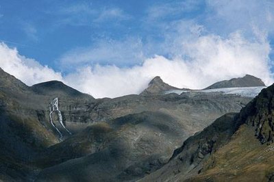
Le fond du vallon de Prariond (Val d'Isère, ZC), marquant la frontière avec l’Italie et le Parc national du Grand Paradis. - PNV - CHASTIN Alain  History
The Monument of Remembrance
This memorial is a reminder of the tragic fate of the British soldiers in November 1944. Captured in Tobruk (Lybia), then imprisoned in Italy where they later escaped, they were aided by partisan Italians in getting to France. In the valley of Prariond, a snowstorm raged. The refuge couldn’t be found as it was buried under the snow. The majority of men died of cold or were buried under avalanches. Only 3 men out of 39 (including one 9 days after the storm) came out of this affair alive, thanks mainly to the aid of the Avalins (inhabitants of Val d´Isère) and other partisan Italians.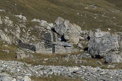
L'ancien refuge PNV, en ruine, de Prariond. Vue vers la Pointe de la Galise. - PNV - FOLLIET Patrick  Small heritage
The former refuge and alpine chalet.
This ruin is the former refuge, which also served as an alpine chalet for the shepherds of the communal flocks. Due to the snowfall covering the shelter, winter access was made via the roof through a still visible chimney equipped with a fixed metal ladder. The enclosure, with dry stone wall (known locally as “rama”), attests to its pastoral use. The chalet has not been used by shepherds since the 1950s. The new Refuge de Prariond, built in 1969 by Vanoise National Park, took over.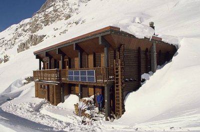
Le refuge PNV de Prariond, en hiver. - PNV - GOTTI Christophe  Refuge
The Refuge de Prariond.
"The Refuge de Prariond is a reception building with constraints specific to the isolated locations. The drinking water supply, more than 800 m in length, is piped from the opposite slope from which it must be conveyed by means of a cable work over Isère! Electricity is produced by photovoltaic panels and a pico-hydrœlectric power station that turbines a small portion of the stream located to the west of the refuge. The provision of food requires 2 to 3 helicopter rotations per year plus wood for heating and gas for cooking. ""Sobriety"" and ""public service"" are the key words for the management of this shelter."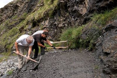
Ouvriers PNV du secteur de Haute Tarentaise déblayant un sentier suite à un éboulement. Gorges du Malpasset, Val d'Isère. - PNV - BUCZEK Jessica  Know-how
Trail restoration
The Vanoise National Park provides trails for summer visitors. There are about ten seasonal workers who work to maintain the 550 km of trails in the heart of the park. The area you cross is subject to regular works to manage the water flows (gully erosion) and off-trail pathways in the bends. The occlusion by vegetation that you see is… 20 years old! Please help to protect the plant-life by staying on the trails.
 Glacier
View over the glacier of the Isère springs from Roche des Loses
Ÿou can see the various glaciers still present around the valley which include, from left to right, the glacier of the Isère springs (cut in 2 by the ridge of the Grande Aiguille) and the glacier of Gros Caval. Two others are hidden from your point of view, those being the Pers glacier (cut in 3 parts) and the Col Pers. The IGN map Top 25 n ° 3633ET 2008 edition shows the glacial retreat between 1975 and 2006. It is illustrated in yellow.