Geotrek-rando
EN
FR
EN
Search
Menu
Filters
2
Practice
Practice
Walking hike
Mountain bike (electric)
Trail
Difficulty
Very easy
Easy
Difficult
Challenging
Duration
0 - 1h
1h - 2h
2h - 5h
5h - 10h
Length
0 - 5km
5km - 10km
10km - 15km
15km - 50km
Ascent
0 - 500m
500m - 1000m
> 1000m
Type
Loop
Return
Crossing
Trekking
Accessibility
Wheelchair
Pushchair
Joëlette
Others
Is in the midst of the park
Themes
Themes
Fauna
Flora
Viewpoint
Architecture
Pastoralism
Geology
Lake and glacier
Summit
Refuge
History
Localization
Localization
District
Arves
Beaufortain
Belledonne
Lauzière
Maurienne
Mont-cenis
Parc national de la Vanoise
Tarentaise
Thabor
Vanoise
City
Clear all
4 results
4 results found
2
Filter
Search
Search
Display Map
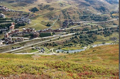
Le hameau des Bruyères et son plan d'eau - STORCK Frantz
Walking hike
LES BELLEVILLE
Family walk around the Plan de l'Eau des Bruyères
Fauna
Flora
Very easy
1h30
2,8km
+32m
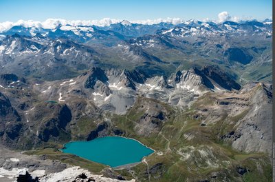
Lac de la Sassière dominé par la Pointe de la Bailletaz - PNV - Herrmann Mylene
Walking hike
TIGNES
Lac de la Sassière
Fauna
Flora
Lake and glacier
Very easy
3h
7,5km
+189m
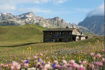
Ambiance au refuge de Plan du Lac - Chloé TARDIVET
Walking hike
VAL-CENIS
Refuge de Plan du Lac atop the plateau
Viewpoint
Very easy
1h
4,5km
+97m
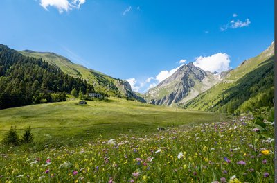
Les prairies fleuries du Vallon de l'Orgère - Chloé TARDIVET
Walking hike
VILLARODIN-BOURGET
Vallon de l'Orgère
Architecture
Fauna
Flora
Very easy
3h30
4,3km
+197m
Loading