
At the foot of the Vanoise glaciers
VAL-CENIS
At the foot of the Vanoise glaciers
Difficult
8h
15,5km
+766m
-783m
Crossing
Embed this item to access it offline
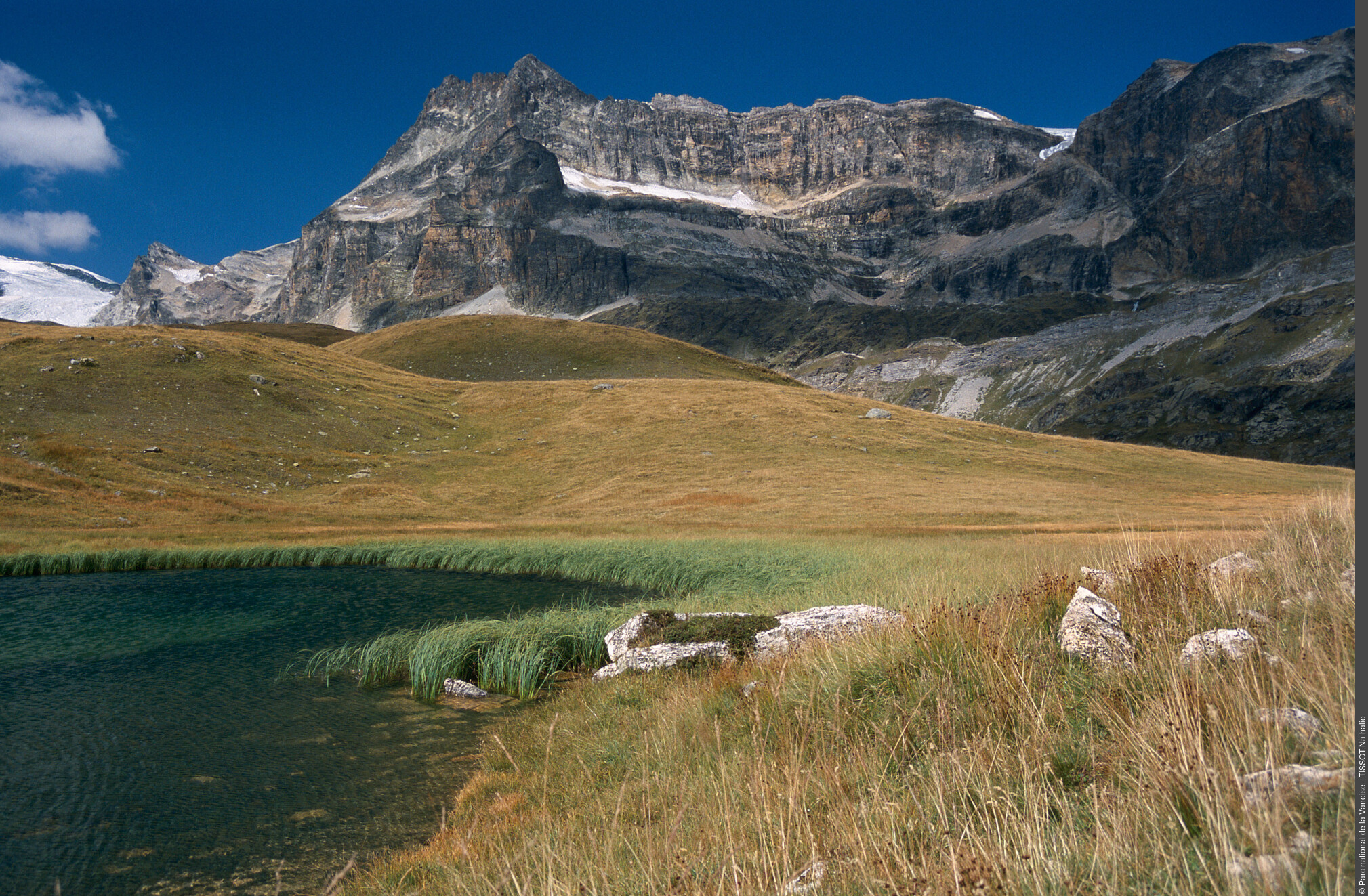
On the way up you will come across some old alpine chalets, while on the way down and in between, you’ll find a mineral world interspersed with some grasslands. Beyond the domestic herds, you may surprise some herds of ibex and chamois quietly settled at the foot of the glaciers or in the gorges that you overlook. This is also the territory of the bearded vulture, the largest nesting bird of prey in Vanoise. Several lakes are to be discovered near the route, testifying to the retreat of the glaciers.
Description
"From the bus stop at Entre-Deux-Eaux, Terminus, walk down the road to a footbridge upstream of the Gorges du Doron. The route leads up initially to a pastoral track near the mountain chalets of Para. The track very quickly turns back to a trail before going back to a terraced route of the GR®5 at an altitude of 2,329 m. At this crossing take the path that climbs gently towards the south, signposted ""Refuge de l´Arpont"". After two hour’s walking it runs along the Lacs de Lozières then bypasses a moraine, crosses screes and alpine pastures. It finally slips in between rocky bars upstream and downstream of the Gorges du Doron where it makes its downward journey. Once at the Refuge de l’Arpont, the trail descends to the Saint-Laurent chapel and old alpine chalets to reach the chalets du Mont. From there, at 2,080 m in altitude, the route leaves the GR®5 to follow a steep descent path that will take you through alpine pastures and then the spruce forest, to reach the valley at Pont du Chatelard. Follow the small south-facing road that leads to the village of Termignon. Walk for 7 hours from the Entre-Deux-Eaux bus stop."
- Departure : Shuttle bus stop of Entre-Deux-Eaux, Termignon
- Arrival : Pont du Chatelard, Termignon
- Towns crossed : VAL-CENIS
Forecast
Altimetric profile
Sensitive areas
Along your trek, you will go through sensitive areas related to the presence of a specific species or environment. In these areas, an appropriate behaviour allows to contribute to their preservation. For detailed information, specific forms are accessible for each area.
Bearded vulture
- Impacted practices:
- Aerial, , Land, Vertical
- Sensitivity periods:
- JanFebMarAprMayJunJulAugNovDec
- Contact:
Recommandations
The starting point for this hike is also accessible, without shuttle, from Bellecombe. The road between Bellecombe and Entre-Deux-Eaux is closed to traffic except for authorised vehicles. (Offence laid down and punished under Article R 163-6 of the Forestry Act).
Is in the midst of the park
The national park is an unrestricted natural area but subjected to regulations which must be known by all visitors.
Information desks
Maison de la Vanoise, Place de la Vanoise, Termignon, 73500 Val-Cenis
Vanoise Information Desk - Termignon
Place Vanoise, 73500 Termignon
Public transportation
"
Rail connection to Modane. Information: www.voyages-sncf.com
Then transport by coach to the administrative centre of Termignon. Information: www.transavoie.com
Then shuttle bus Termignon-Bellecombe-Entre-Deux-Eaux, from July to August and the weekends from 15th June to 14th September.
Shuttle bus information: www.termignon.haute-maurienne-vanoise.com/pratique/se-deplacer-sans-voiture
Suggested hitchhiking organised in the Haute-Maurienne valley. Information: www.rezopouce.fr
"Access and parking
Shuttle bus departure at Termignon-Bellecombe-Entre-Deux-Eaux to Maison de la Vanoise, from July to August and the weekends from 15th June to 14th September.
Parking :
Termignon, then shuttle bus to Entre-Deux-Eaux
Route planner
More information
8 points of interest
Plan du Lac - Nathalie TISSOT  Lake
LakeThe Plan du Lac
The Plan du Lac is a grassland lake. The banks are alive with rushes and sedges. The bottom is lined with stoneworts, edged by some broad-leaved pondweed. The lake is stocked with brown trout and schools of minnows wander here and there. It’s a good breeding ground for the common frog. The permeability of the limestone substratum leads to a significant drop in the water level at the end of the season.
 Pastoralism
At Plan du Lac
The pastoral road which passes in front of the Refuge de Plan du Lac serves the various alpine pastures where the farmers graze their herds of cows and sheep. This is where Beaufort, Tome de Savoie and Bleu de Termignon are made. This road is an old communication and trade route between the valleys of Tarentaise and Maurienne, via the Col de la Vanoise that links Pralognan-la-Vanoise to Termignon. It’s the “salt and cheese road”.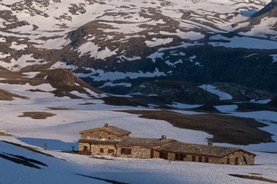
Le refuge-porte PNV du Plan du Lac à l'aube. Vue sur le Dôme de l'Arpont. Termignon. - PNV - DELORME Michaël  Refuge
The Refuge-Porte de Plan du Lac
The Refuge-Porte de Plan du Lac has been certified “Accessible Tourism” for the 4 disability types. Advantageous features:
1- Complementarity between high-mountain catering and accommodation and a place of interpretation;
2- Located in the heart of the oldest of the French national parks;
3- A visual perspective close to 360° over the glaciers and the highest peaks of Vanoise including La Grande Casse (3855 m);
4- Immersion in nature at more than 2,300 m in altitude.
Refuge with 42 beds, 1 room and 1 sanitary facility for disabled people.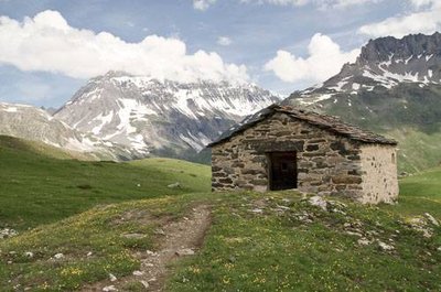
Sur la Route du sel et des fromages : la chapelle Saint Barthélémy. - PNV - TISSOT Nathalie  History
The Chapel of Saint-Barthélémy
"This chapel stands on 15th century foundations. It was restored in 1997 in partnership with Vanoise National Park. Saint-Barthélémy helps to fight against ""diabolical"" diseases and the plague. He promotes wound healing despite the fact that he was skinned alive! The reconstruction of the chapel in 1633 is certainly the result of a plague epidemic in Maurienne, where it took 224 people to Termignon. The peddlers, who carried goods from the East, were potential vectors, which explains this call for protection in the mountains."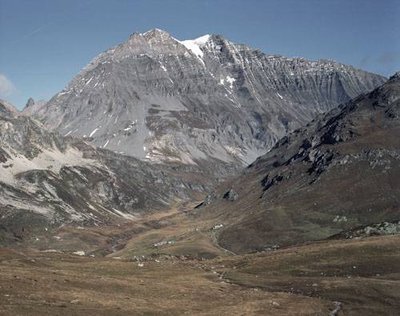
1er pl., alpages de Pensamen. 2e pl., alpage et hameau d'Entre Deux Eaux. À l'arr.-pl., Pointe Mathews (g) et Grande Casse (d). - PNV - VON CONTA Beatrix PastoralismThe Alpage de “la Para”
"At the foot of La Leisse and La Rocheure valleys, the tarentaise and abondance dairy cows and the Thônes and Marthod sheep graze on the slopes, at first gentle and then very steep, of the “Para” pasturelands. The local alpine farmers transform the milk from the cows on the pastures into two types of cheese: the Termignon blue, a rare product which is thinly veined and crumbly, as well as the Beaufort, a pressed-cooked raw milk cheese. Originally from Beaufortain, from which it takes its name, the production of the ""prince of the Gruyères"" is now widespread in the valley of Maurienne. As for the sheep and their lambs, they follow the snowfall cycle from spring to autumn to enjoy the full benefits of the richness of the high-altitude pastures."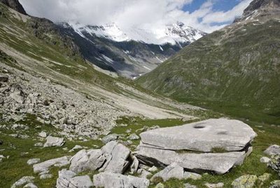
Pierre à cupules (calcschiste à grain fin et tendre pour la gravure) et son "escalier". Fd. Vallon de la Leisse. - PNV - TISSOT Nathalie  Archaeology
Cup-shaped stones
A little under the spot height 2,329 m, when you take the GR®5 Sentier Balcon (terraced path), you will discover an engraved stone dating from the Neolithic (3000 years BC). These were the first agropastoral communities that made these engravings by staking out erratic blocks or rock outcrops. The Maurienne valley conserves nearly a thousand highly diversified engraved rocks (engraved feet, battle or hunting scenes, abstract representations, roundels, names of shepherds, etc). They testify to the populations present in the high mountain in remote periods. The erosion and human induced degradations have weakened these stones over time. To testify to their history in the centuries to come, they deserve your attention.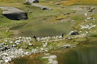
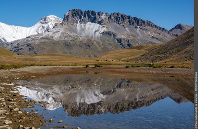
Randonneurs marchant en bordure des Lacs des Lozières. - PNV - TISSOT Nathalie LakeThe Lacs des Lozières
"The track merges between the natural lakes of Lozières. These depressions were originally formed by the hollowing of glaciers or moraine deposits, such as the ""glacial lakes"" of Roche Ferrran and Pelve which are located upstream. But as they are older and lower in altitude than their neighbours, the “grassy lakes” of Lozières vegetate. Ÿou will therefore find aquatic vegetation, such as the bur-reed, a flowering plant which forms long filaments on the surface of the water. Ÿou can also see curious pompoms on an erect stem, the Eriophorum scheuchzeri. This plant species dœs not tolerate competition, it colonises only the lake shores on siliceous ground."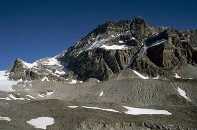
Moraine latérale du Mont Pelve. - PNV - GARNIER Alexandre  Glacier
The Dôme de Chasseforêt, the Pelve moraine
At this point you go along the lateral moraine of Mont Pelve. This mass of rocky debris was torn from the mountain by friction from the glacier and freezing/thawing. As it retreated, the glacier revealed this moraine which is evidence of the ancient glacial area. The glacial ice cap of the Vanoise domes extends over 13 km in length and covers an area of 32 km². In the 20th century, it retracted by 420 metres in 50 years. It continues today at a rate of one metre per year. A climb of up to 2,700 m in altitude is now required to reach the glacier.