La Pierre aux Pieds
VAL-CENIS
La Pierre aux Pieds
Difficult
6h
16,9km
+1179m
-1183m
Loop
Embed this item to access it offline
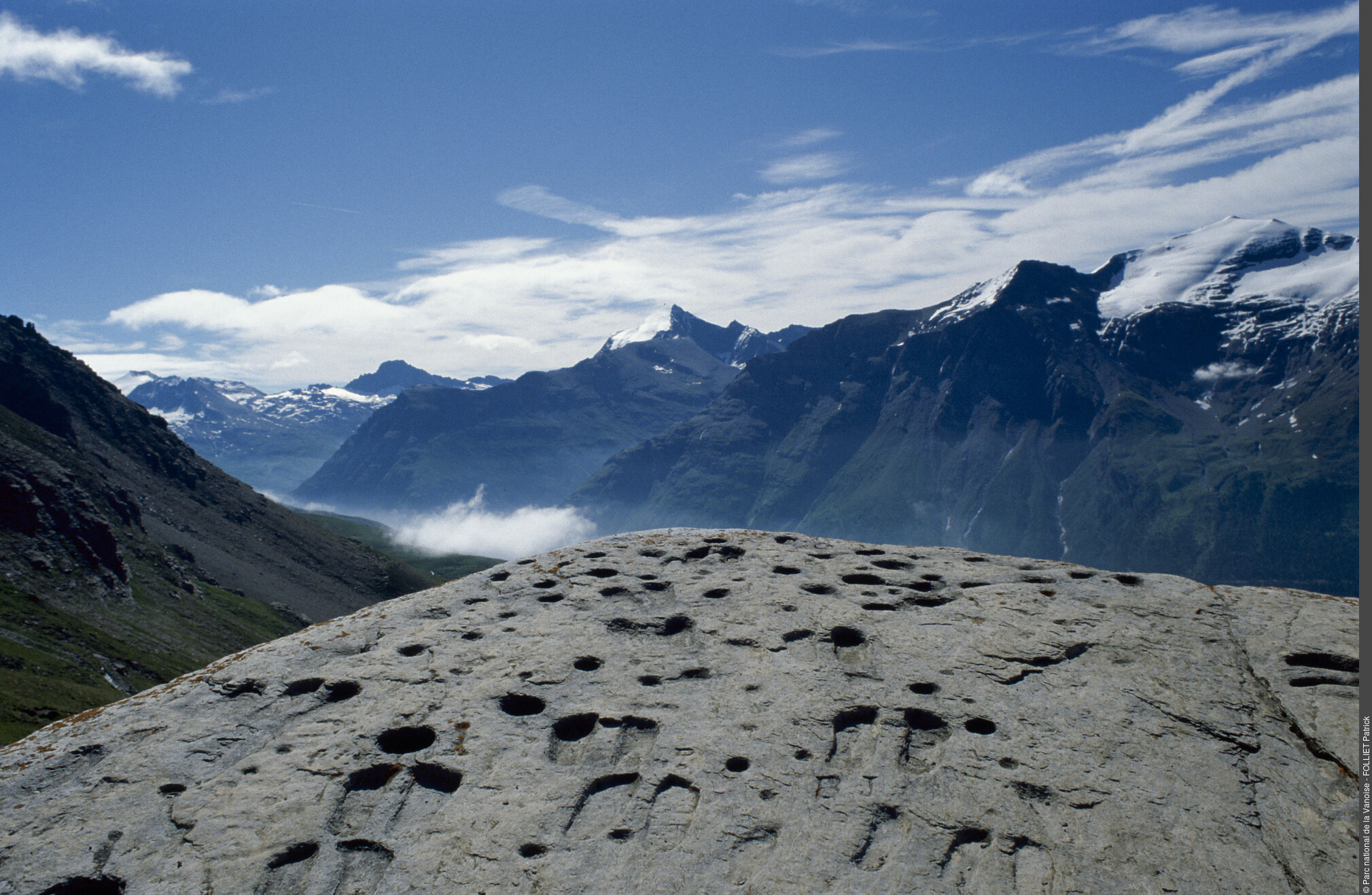
"We leave ""in search of the lost past"". For us, modern men, stepping foot on these high-altitude territories lets us renew the powerful ties which united our distant ancestors with the natural elements. The screes, peaks and surrounding glaciers, will perhaps reveal the meaning of the engravings and the motivations of their authors nearly 4,000 years ago. Jean-Ÿves Ployer, ranger."
Description
From the chapel of Sainte-Marie-Madeleine, the trail (in the direction of the Refuge de Vallonbrun) rises in to a sparse forest of conifers and bypasses rocky outcrops. A well-developed ericaceous moor covers the slopes. The trees gradually disappear and give way to the pastures. Pass through the ruined barns of Mollard. Then make a sharp left turn (leave the path leading to Châtelard on your right). The path then leads to the chapel of Saint-Antoine, clearly visible on its promontory (approximately 2,300 m in altitude). Nearby, the chalets of La Fesse d´en haut mark the upstream Vallonbrun valley. Go down to the refuge by the track. Below the refuge, turn right (GR®5) in the direction of Pierre aux Pieds: entrance to the heart of the National Park. The trail, which is initially wide up to the chalets of La Fesse du Milieu then runs along the slope gently climbing and crossing several streams. Before the Plan de la Cha, take a wide path on the right (old track created for works). Start of the section of the route outside the GR®5. Reach a small pass (approximately 2400 m in altitude) where the horizon emerges. Continue north (slight descent), and pass the Diet stream (no footbridge). A rising crossing lets you gain a foothold on the plateau of Marmottières. The winding path then crosses a steep area of approximately 200 m in ascent. The relief eases. Continue for 300 m to reach the destination of the hike: the engraved erratic block of the Pierre aux Pieds.
Go down the same route to the Refuge de Vallonbrun, then take the pastoral track downstream for 900m before forking left at the Fesse d´en-Bas on a trail leading down to the mountain pastures, then in to a forest to the first hairpin bend of the forest road of Grattais. Reach the Col de la Madeleine by descending for 500m then climb up the small paved road for 1 km to the hamlet of the Collet de la Madeleine, the starting point.
- Departure : Hamlet of Collet de la Madeleine (towards the chapel of Sainte-Marie-Madeleine), Lanslevillard
- Arrival : Hamlet of Collet de la Madeleine (towards the chapel of Sainte-Marie-Madeleine), Lanslevillard
- Towns crossed : VAL-CENIS
Forecast
Altimetric profile
Recommandations
It is advisable to stay overnight at the Refuge de Vallonbrun and to complete the hike in one and a half days because, even if the gradient difference is not huge, the distance to travel is substantial. Suggestions: climb to the refuge in the afternoon and continue the hike the next day or climb to Pierre aux Pieds and stop at the refuge to complete the descent the next day.
Is in the midst of the park
The national park is an unrestricted natural area but subjected to regulations which must be known by all visitors.
Information desks
Rue sous l'Eglise, Lanslevillard, 73480 Val-Cenis
Transport
"
Rail connection to Modane. Information: www.voyages-sncf.com
Then transport by coach to Lanslevillard. Information: www.transavoie.com
Suggested hitchhiking organised in the Haute-Maurienne valley. Information: www.rezopouce.fr
Additional information:
"Access and parking
From the Tourist Information Office of Lanslevillard, go in the direction of Bessans via the D902. Climb the bends leading to the Col de la Madeleine. At Pré Clos (about 1 km before the pass), turn left onto the paved road (leave the Grattais forest track on your left) which leads to the hamlet of Collet located 1.5 km away.
Parking :
No parking available (park along the road, after the chapel)
More information
10 points of interest
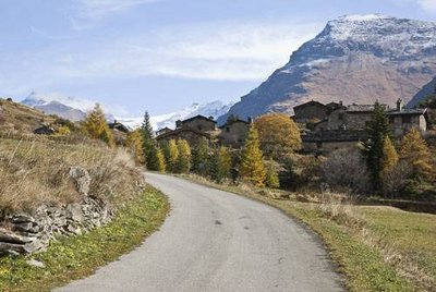
Le hameau du Collet au Col de la Madeleine, commune de Lanslevillard. Au fd. à dr., la Crête de Tierce, commune de Bessans. - PNV - JOURDAN Jérémie  Architecture
Hamlet of Collet de la Madeleine
Built in stone with lauze roofing, this hamlet testifies to the traditional architecture of Haute-Maurienne. It is the highest hamlet in the town. It is located on an enormous landslide resulting from the collapse of a portion of the Pointe des Pignes on the left bank of the Arc (12,000 to 15,000 years BC). Once composed of barns and a few chalets used in summer, it is currently inhabited annually by two people. It was in 1972 that an alternative route was created to allow easier access to Bessans by bypassing the hamlet.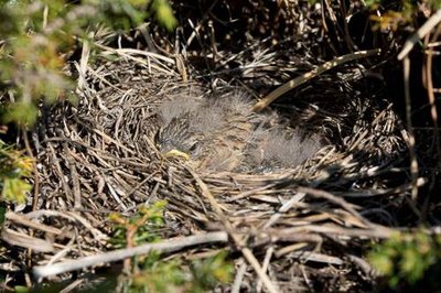
Bruant fou : nid contenant une couvée, dans un genévrier. - PNV - PLOYER Jean-Yves  Fauna
FaunaSparrows in the woody area at the start of the route
The mosaic of environments making up the first hectometres of the route (groves, moors, fallow meadows) welcomes a rich avifauna. Ÿou will move on to the kingdom of the sparrows so stay alert (pair of binoculars recommended). In spring, you may even come into contact with two species of galliform on these slopes: the rock partridge (Alectoris graeca) and the black grouse (Tetrao tetrix).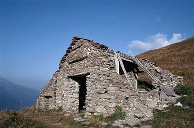
Grange en ruine au hameau du Mollard. Maçonnerie avec pièce de bois pour la structure. - PNV - BRUGIÈRE Yves  Architecture
Ruined barns of Mollard
"The vestiges of a bygone past where these slopes were still grazed and / or mown, these buildings deserve a small pit stop to admire their dry stones, lauze roofs, wooden lintels, columns and frameworks and ""tsardzou"" (a sloping ledge in front of the barn for loading and unloading hay). A little higher up, to the left of the path, two isolated barns display two ancient chronograms (engraved stones) which date from 1624 and 1690."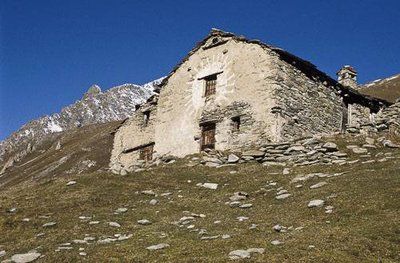
Chalet d'alpage, avec façade porteuse d'un cadran solaire, réalisé à la chaux. La Fesse d'en haut, Lanslevillard. - PNV - GROSSET Félix  Architecture
Alpine chalets of Fesse d’en haut
Some chalets are still used today. One of the buildings is distinctive for its façade on which a sundial has been painted in lime.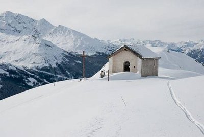
La chapelle Saint Antoine de Vallonbrun. - PNV - JOURDAN Jérémie  Architecture
Chapel of Saint-Antoine
Located at 2,290 m in altitude at Fesse d´en haut, it was built in 1876 on the site of a very ancient oratory. Partially destroyed by an avalanche, it was rebuilt in 1932. Saint-Antoine is the patron saint of mule-drivers. The chapel now serves to illustrate the natural heritage.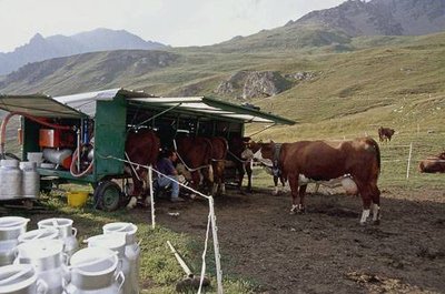
Traite en alpage par l'agriculteur Jean-François GAUDIN (GAEC de Vallonbrun). - PNV - HÉMERAY Damien  Pastoralism
Alpine grazing in Vallonbrun
Vallonbrun is one of the three great alpine areas of the Lanslevillard municipal area. The GAEC of Vallonbrun takes its cows up there (tarentaise and abondance breeds) in summer. There is no cheese making here in the alpine pastures: milk is taken down every morning to the Val Cenis-Vanoise dairy cooperative, located in Lanslebourg, where it is used mainly to produce Beaufort (PDO). During the summer grazing period, an ovine herd (about 800 animals) grazes on the highest slopes under the stones and the cliffs. The sheep are raised for meat (lamb production in particular), there is no production of milk or cheese.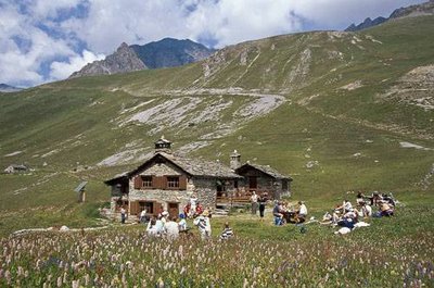
L'extérieur du refuge PNV de Vallonbrun avec de nombreux randonneurs. Prairie de fauche à renouée bistorte au premier plan. - PNV - HÉMERAY Damien  Refuge
Refuge de Vallonbrun
This refuge, originally an alpine chalet, has been converted and renovated. These are solar panels that provide the energy necessary for the building. This 27-place refuge, managed by the National Park, is looked after by Frédéric Étiévant (Refuge Tel: 04 79 05 93 93)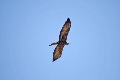
Adulte d'aigle royal en chasse au dessus de la cave des Loyes. - PNV - JORDANA Régis  Fauna
FaunaLarge birds of prey towards Roc de Burel
The large birds of prey love this area Open your eyes and you may be lucky enough to see the magnificent sailing ship that is the golden eagle (Aquila chrysaetos), the bearded vulture (Gypaetus barbatus), the griffon vulture (Gyps fulvus) and the black vulture (Aegypius monachus) come to summer.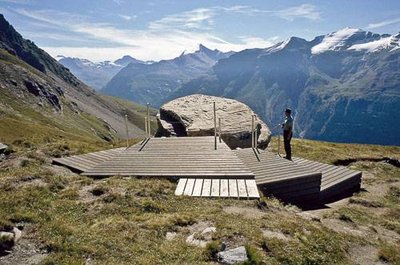
La Pierre aux Pieds, avec l'estrade d'observation. - PNV - BLANCHEMAIN Joël  Archaeology
La Pierre aux Pieds
"Classified as an ""historical monument"" in 1911, the Pierre aux Pieds is the most imposing of the engraved rocks of Haute-Maurienne. This shiny block of schist has 82 hollow feet (rather small), of which 33 are pairs and about 50 cupules. It is estimated that these engravings would have been made during Protohistory (1,800 to 15 BC). Other inscriptions and a sword were later added. There is no certainty as to the meaning of these engravings. A number of theories have been put forward but the mystery remains."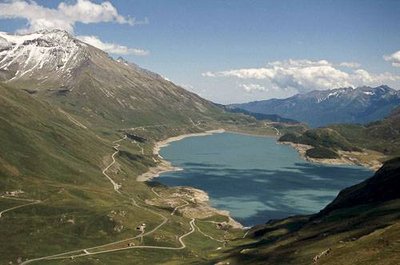
Le Lac du Mont Cenis. - PNV - HÉMERAY Damien  Viewpoint
Panoramic view from “Pierre aux Pieds”
"The area of ""La Pierre aux Pieds"" is the outlook of choice to gaze upon the Col du Mont-Cenis and the many surrounding peaks (in particular: Grand Roc Noir, Pointe de Ronce, Pointe de Charbonnel and Albaron)"
