
Petit Mont-Blanc and the Merlets Lakes
The Petit Mont Blanc was called the “Salt Mountain” by the old Pralognanais. Its salt, actually gypsum, was used for the manufacture of plaster to seal the dry stone walls. To upstage Chamonix, the capital of mountaineering, Pralognan-la-Vanoise, the capital of hiking renamed its Salt Mountain to Petit Mont-Blanc. Incidentally, the view of Europe from the summit of this mountain is stunning. The surreal lunar atmosphere at the summit of the Petit Mont-Blanc offers a 360° view of the Vanoise glaciers, Mont Blanc, the Gébroulaz glacier or the valley of the Avals valley. Clarisse Pellet, Vanoise National Park Ranger.
Description
"From the car park at Les Prioux, cross the hamlet and walk for 150 m. Take the trail in the direction of “Petit Mont-Blanc”. At the 2 following forks in the road, stay on the right trail. At the Col du Mône, follow the “Col des Saulces”. At the junction of the Col des Saulces, follow the “Refuge du Grand Plan”. At the fork in the trail 300 m after this refuge, take the trail on the left and follow “Lacs Merlets”. Once at the crossroads, take the path on the right towards ""Refuge des lacs Merlets"". The next day, upon leaving the refuge, retrace your steps at the crossroads. Take the trail in the direction of “Col de Chanrouge”. Walk past the pass, then the stream below. At the intersection turn right in the direction of “Col Rouge”. Go past the pass. After 690 m of downhill ascent, follow the vehicle track to the car park of Pont de la Pêche. Follow the paved road for about 850 m, take the footbridge over the Doron on the left of the road. Follow the trail along the Doron, until the hamlet of Les Prioux."
- Departure : Car park, les Prioux, Pralognan-la-Vanoise
- Arrival : Car park, les Prioux, Pralognan-la-Vanoise
- Towns crossed : PRALOGNAN-LA-VANOISE, SAINT-BON-TARENTAISE, and LES ALLUES
Forecast
Altimetric profile
Recommandations
Remember to bring water for the day (no water sources are available)
Information desks
Maison de la Vanoise, Avenue Chasseforêt, 73710 Pralognan-la-Vanoise
Public transportation
"
"
Access and parking
RD915 until Pralognan-la-Vanoise, then the municipal path.
Parking :
Route planner
Accessibility
No
- Emergency number :
- 114
More information
10 points of interest
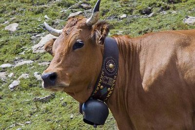
Vache de race Tarentaise. - PNV - BASSARGETTE Denis  Know-how
Les Prioux
"Stop at the hamlet of Les Prioux, to witness (depending on the time) the making of Beaufort at Rolland. This cow’s cheese, cooked, pressed and smear-ripened (salted and rubbed) has been labelled PDO (formerly CDO) since 1968. It is known as the “prince of gruyères”. Only the tarentaise and abondance breed can claim to give their milk. The appellation ""Beaufort d´Alpage"" is attributed only to cheeses made in summer, with the milk of a single herd, as is the case with your hosts."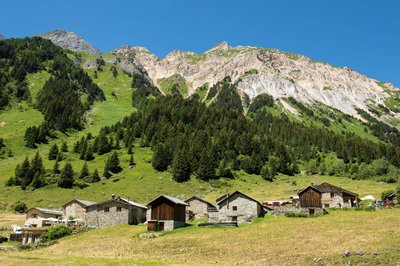
Le hameau des Prioux - Gilles Lansard  History
Les Prioux hamlet
At the edge of Vanoise National Park, Chavière Valley unveils its natural wonders along a refreshingly varied path: the Savoyard discovery tour around Les Prioux.
Life in this hamlet, perched at an altitude of 1,700m, is still very much in step with nature and the winter and summer seasons, and residents have had to adapt accordingly. As they are cut off from the world through the long winter months, they have so much to share with you about life in the past: the mountain pastures, making Beaufort cheese, the growth of tourism and mountain crafts and trades...
This refreshingly varied path unveils the wonders of Chavière Valley to you, with its awe-inspiring peaks and more relaxing hamlets.
The route is accessible to everyone, including families with pushchairs, the elderly and wheelchair users with helpers.
• Round trip takes: 40 minutes
• Elevation gain: 10 metres
• Distance: 1km 100
People with reduced mobility can reach Les Prioux via an adapted shuttle bus.
Open from 15 May to 30 September, except if snow closes the road to Les Prioux.On-site you’ll find a cheese dairy, restaurants and accommodation options, to make a proper holiday out of your trip!
Vue sur le Petit Mont Blanc. - PNV - GARNIER Alexandre  Flora
FloraThe Ecological Land Reserve of Petit Mont-Blanc
The Ecological Land Reserve of Petit Mont-Blanc was established in 1999 because of the site’s high heritage value. It is managed by the National Forestry Commission which is responsible for maintaining the richness of this area over the long-term. Indeed, there are remarkable habitats to be found here with a substantial floristic diversity (319 listed plant species, of which 11 are protected at national level) A Natura 2000 area, the “Vanoise Massif” stands supreme over this reserve. This area is comprised of arctic-alpine riverside grasslands hosting specular blue thistles and giant scabiosa.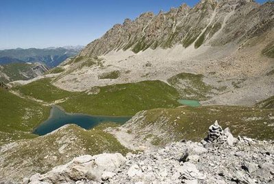
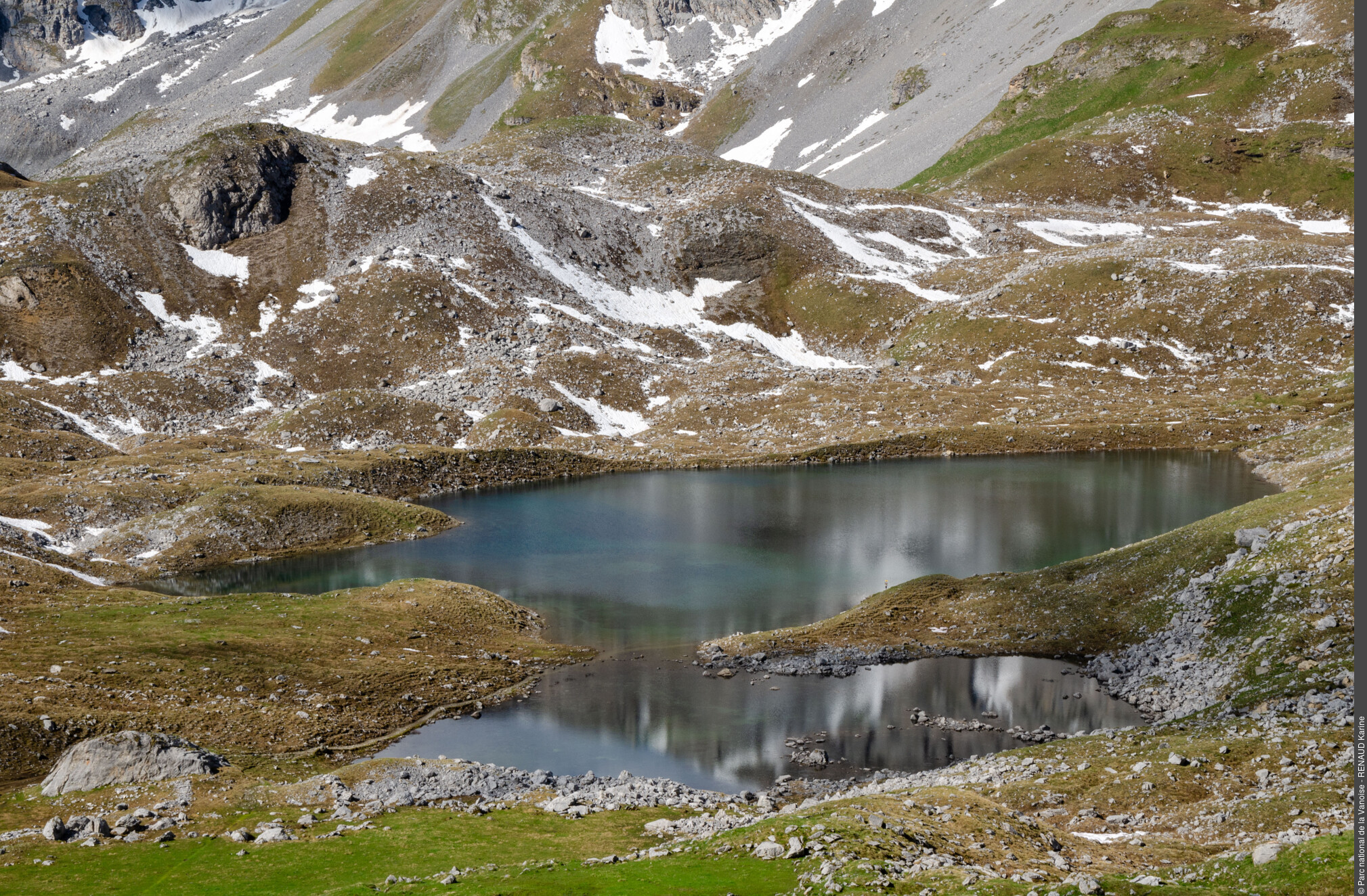
Lac du Rateau et combe du Rateau. Cairn au 1er plan. Au fd. à dr., Roc du Mône. - PNV - STORCK Frantz  Geology
Col du Mône
The Col du Mône is located on a fault line that separates two different geological formations: the Mône rock which is a formation of limestones and dolomitic stones from the Jurassic whose stratigraphic series is reversed, and the Petit Mont-Blanc which is formed of gypsum, a very white rock. On the Mône rock, the rocks are rather grey, formed in layers with a reddish layer of bauxite, a rock rich in aluminium and iron oxide. The Petit Mont-Blanc looks like a lunar landscape with its white, globe-shaped rocks.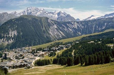
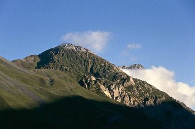
Piste de ski et village de Courchevel 1850. Vue sur la Dent du Villard et la Crête du Mont Charvet. - PNV - STORCK Frantz HistoryThe etymology of Courchevel
"The origin of the name Courchevel comes from the local terroir and agropastoral practices. Thus in the spring, when the herds of tarentaise cows were moved at altitude to the montagnettes, between 1,500 and 1,800 metres in altitude, the herdsmen were prohibited from stationing their herds on the strips of land where the green grass grew profusely, as although appetising it was capable of cutting the cows’ tongues, enough to “skin it”. This explains the origin of the town’s name, “écortzevé” in saint-bonnais patois, which over the centuries and oral transmission, became “cortzevé”, then “corchevé” and finally “courchevel”. In the 19th century, the maps mention the place known as ""Les chalets de Corchevel"", today ""Courchevel 1550"". The name Courchevel became permanent at the beginning of the 20th century."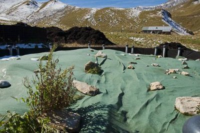
Cuve de lombricompostage en fonctionnement depuis 2 ans, contenant du compost mis sous bâche. Arr.-pl., compost supplémentaire. - PNV - AUGÉ Vincent  Pastoralism
Alpage des Avals: the secret of an earthworm
"I am the redworm, the earthworm compost: I digest the whey produced from cheese making by ""vermicomposting"". I need a dark, damp and well-ventilated place to live. This is why the compost here is protected by opaque tarpaulin that allow air to flow through. The farmer regularly sprays it with the whey. In order to move and feed myself, I dig tunnels. This facilitates the circulation of liquid and contributes to the mixing and aeration of the earth. The oxygen available allows the bacteria to break down the organic matter that make up the whey."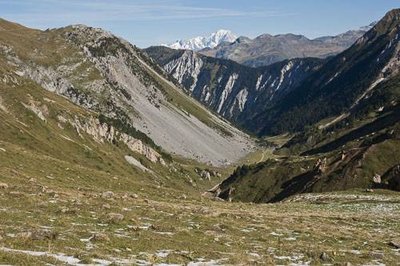
La Vallée des Avals et la Dent du Villard, fermant la vallée. - PNV - AUGÉ Vincent PastoralismThe Alpage des Avals: Beaufort cheese
"The Alpage des Avals is managed by a pastoral consortium whose cattle herd totals approximately 150 cattle. These cows graze around the villages until June and then climb up into the mountain pastures. Their presence in the municipality lasts 8 months. Saint-Bon-Courchevel is located in the Beaufort protected designation of origin area. In the alpine grazing season, the cheese, made on site, can use the ""Beaufort d´Alpage"" label. Almost all farmers are engaged in a dual activity relating to tourism. In winter, they work as ski instructors, shopkeepers, piste service or ski lift operators."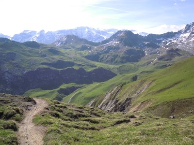
Vue sur le petit Mont-Blanc et les glaciers de la Vanoise - Hervé Franchino  Viewpoint
Alternative round trip towards Col des Saulces
For those who fancy it, there's an alternative round trip up to the Col des Saulces pass, at an altitude of 2,456m. From there you'll be rewarded with lovely panoramic views over Pralognan-la-Vanoise valley. To the left of the pass is the Petit Mont Blanc (2,677m) and to the right, the Rocher de Plassa (2,867m). You'll also be able to glimpse the Aiguille du Fruit peak (3,051m) and the Avals Valley.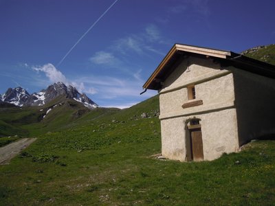
Ancienne cave du Biol - Hervé Franchino PastoralismBiol cellar
An old cheese cellar to start the maturing of the Beaufort cheese wheels during the summer period, which were then taken down into the valley to finish their maturing. The building dates from the 19th century and was renovated in the 2000s.
Nearby is the cellar and the chalet de la Grande Val, still used nowadays to make the beaufort "chalet d'alpage"; with a tool renovated in the years 2010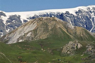
Vue sur le Petit Mont Blanc avec le Col des Saulces (à g.) et le Col du Mône (à dr.). - PNV - GOTTI Christophe GeologyDents de la Portetta, Petit Mont-Blanc and the Aiguille du Fruit
At the secondary level, Saint-Bon-Courchevel is located under a shallow sea where phenomenal amounts of sand and crustaceans are deposited and which has undergone episodes of retreat and advance. The accumulation of crustaceans is the source of the limestone rocks. The Dents de la Portetta are the most representative. Then, under a tropical climate, the sea receded by evaporation. This phenomenon is the cause of a particular rock, gypsum. This rock constitutes the Petit Mont Blanc massif, the crests of Mount Charvet and the Dent du Villard. Later, the sea covered the town again, which is what caused the formation of the limestone rocks. The Aiguille du Fruit was formed during this period and contains an astonishing variety of fossils, such as shark teeth.