Two-day tour of Vallaisonnay
>>
Home
>
Walking hike
>
Two-day tour of Vallaisonnay
CHAMPAGNY-EN-VANOISE

Two-day tour of Vallaisonnay

Fauna
Pastoralism
Viewpoint
Embed this item to access it offline
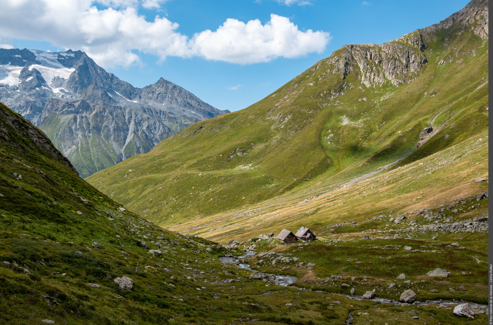
Far from the tumult of the great towers of Vanoise, the tour of the Vallaisonnay provides an opportunity to enjoy the surrounding nature. Panoramas and views over the highest peaks of the massif, great wildlife and alpine flowers are part of the itinerary.
"To experience the mountain is to let the senses take over: the roar of the cascading waterfall, the silence of the mountain in the early morning, the wind in your face as you walk through a pass, the brightly coloured flowers or scent of fresh grass, first or last rays of the sun reflected by the glaciers... Walking around Vallaisonnay will bring all these emotions to life! Walking around a mountain dœsn’t involve ""walking round in circles"", but discovering that very close valleys can be completely different in character. An overnight stay in a refuge gives you the chance to immerse yourself in the unique atmospheres of the morning and evening and to take the time to look, feel, touch and listen to what the mountain has to say. Alexandre Garnier, Vanoise National Park ranger"

22 points of interest
Glacier

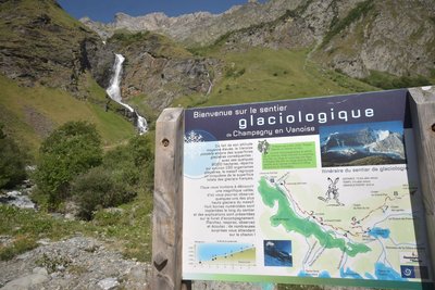
Glacier Trail

Take in the valley’s true magnificence from the Palet Pass, which provides you with views of some of the massif’s highest glaciers, with eight numbered marker posts located along the trail by the Vanoise National Park.
The itinerary, which takes around 4 hours to complete, was created and waymarked by the Vanoise National Park. The accompanying booklet contains all the information you might need as you get better acquainted with mountain glaciers.
On the itinerary: the Glière mountain hut (restaurant service and beds for the night), the high mountain pastures of the Plan du Sel and the secrets of Beaufort cheese production, and above all, no end of marmots!
You can get a copy of the booklet at the Laisonnay Reception and Information Point.
read more
Water

The Py Waterfall

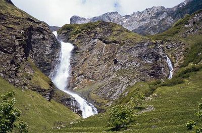
What could be more refreshing than starting your hike under the spray of the Py waterfall standing at 80m high! Ÿou will follow the mountain stream of the same name throughout the whole ascent towards the “Refuge de Plaisance”. In the mountains the variations in stream flow are impressive! In spring, the meltwater hurtles down the slopes at full speed while in the autumn the water subsides. The colour of the water can also change: a violent thunderstorm can quickly turn this clear water into black mud. A hundred years ago, it was still possible to pass between the waterfall and the wall without getting wet! This is unthinkable today, which just gœs to show how strong the eroding Py stream is.
read more
Water

The Py waterfall

A truly spectacular sight! A bridge spans the watercourse, providing a perfect vantage point to admire this magnificent 80-metre waterfall and bask in its refreshing spray.
read more
Fauna

The alpine ibex

To the west, on the slopes of the “Chardes” massif is the kingdom of the alpine ibex. Its history is closely tied to that of the National Park because, after almost disappearing from the massif, the ban on hunting in the heart of the Park saved the last individual animals. In Champagny, National Park agents even expedited its return since in 1980, about fifteen animals were reintroduced after being captured in Maurienne. It is not uncommon to see the large males in June around the shelter and not very far from it on summer evenings. Females are more discreet; they occupy cliffs and rocky ledges in order to give birth and raise their young away from prying eyes.
read more
Refuge

The Refuge de Plaisance

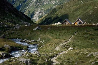
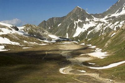
The two “Chaloin” chalets at the Refuge de Plaisance were built by Vanoise National Park. They have suffered the rigours of winter on two occasions: in February 1999, a remarkable avalanche pushed the bunkhouse chalet, which weighs about ten tons, against the building housing the dining room. In January 2004, the roof of the chalet was damaged by a storm. Life is hard for the mountain refuges in winter!
read more
Flora

Plan Séry and its flora

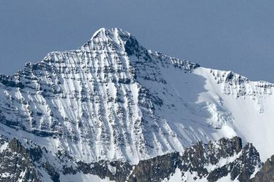
This lake now has more water and what a sight! This vast expanse appears to be an ancient dried glacial lake. If you take the time to look more closely, you might find the carex bicolor, a small protected plant. This small grass can be recognised by its small two-toned spikelets in pistachio and chocolate. Like all rare species in Vanoise, Park agents map it to assess its presence within the territory. It is much less spectacular than the edelweiss that you can admire all around the lake. Even if this species is not protected contrary to popular belief, do not pick it! Flower picking is strictly prohibited in the heart of the Park especially because other hikers should be able to admire the snow stars.
read more
Lake

Lac de Plagne

Lac de Plagne (2,144m in altitude) is one of the 3 lakes in the upper valley of Peisey Nancroix (you will also see Lac Grattaleu and Lac Verdet during this hike) which covers an area of 7.6 ha and has a maximum depth of 19 m making it one of the deepest lakes in Vanoise. Like many mountain lakes, it was stocked with young char fish from Canada (or lake trout) some years ago for fishing. Originally adapted to the extreme conditions of the polar regions, this species of fish is capable of withstanding extremely rigorous environmental conditions (very harsh and prolonged winter conditions, absence of light, low temperatures, etc.).
read more
Viewpoint

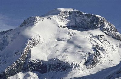
The Grande Casse

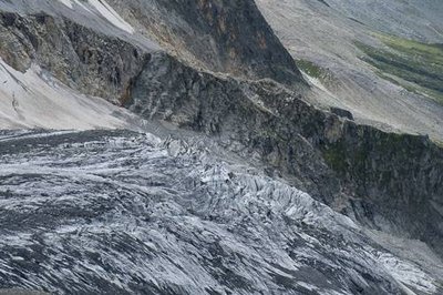
From the Col de la Grassaz you can admire Vanoise’s highest summit, the Grande Casse standing at 3,855 m. The first ascent of the Grande Casse was made on 8th August 1860 by William Mathews, a British climber and his guides Michel Croz and Étienne Favre. But the impressive facing slope, with its hanging glacier, is the north face of the mountain and was much harder to climb. And so the first journey of the north-north-west face of the Grande Casse was made by Victor Puiseux and his son Pierre Puiseux, Amédée Crochet and Joseph Amiez.
read more
Fauna

The chamois

"The scree and grassy bumps provide the perfect grounds for the chamois to inhabit. Distant cousin of the antelope, it is much more at ease than the ibex in the snow. Its small hooked horns of ebony black and its white and black striped mask make it easy to recognise. Open your eyes, get out your binoculars, and most importantly listen to the mountain; just a few rolling rocks are enough to identify the presence of these animals. With a bit of luck, you can see the little ones play on a névé under the watchful eye of their mothers who gather them in a ""nursery"" to better guard them."
read more
Glacier

The glaciers

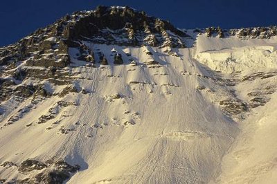
On the left bank (downhill) of the Glière valley, there are about ten glaciers. They resist melting thanks to the shadow of the mountains looming over them. Here you can see the cirque glaciers (Becca Motta, Nord de la Glière), glaciers of the slope (Volnets, Troquairou), the valley (Epéna, Rosolin, Roche du Tougne), restored glaciers (Pramort) and the ice cap (Grande Motte). They cover a surface of 12 km2.
read more
History

Mountaineering

Unlike Pralognan-la-Vanoise, Champagny-en-Vanoise was very late to be visited by mountaineers. The high summits were first climbed by the easiest slope, from Pralognan (Grande Casse, Épéna and Grande Glière). Thus, the northern faces were only scaled later: the small northern face of the Grande Casse by the Puiseux brothers in 1887; the Couloir des Italiens in 1933 and the northern face of the Epéna in 1966. Other famous northern faces had to wait until the twentieth century to be scaled. Grandes Jorasses, Cervin and Eiger.
read more
Pastoralism

Beaufort cheese

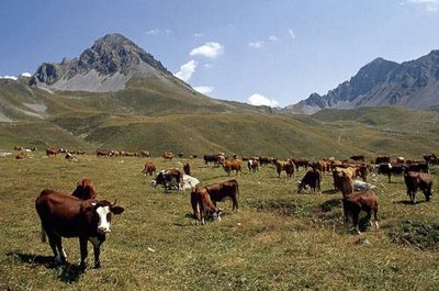
La Grande Plagne and its chalet of Plan du Sel is one of the places where the Beaufort d’Alpage is made. Raw whole milk, from tarentaise and abondance cows, is press-cooked, with at least 50% fat, moulded into a concave heel circle, before developing a natural crust which is strengthened by regular brushing. Each cheese weighs between 30 and 60 kg, with a diameter of 40 to 60 cm and a thickness of 12 to 16 cm. The Protected Designation of Origin imposes undeniable constraints, such as the obligation to manufacture cheese with the milk of a single herd twice a day. But it also ensures that quality farming in the high mountains is maintained which is essential to sustaining the Vanoise landscapes...and, in addition, is pleasing to the palate since this cheese is delicious!
read more
Pastoralism

The mountain pasture of Grande Plagne

The alpine farmers lead the cows every year on to the mountain pastures of the Grande Plagne. At the chalet of Plan du Salt (2,250 m), the milk of the tarentaise and abondance cows (the only breeds authorised under the Beaufort PDO) is transformed into Beaufort d´Alpage over 100 days. The weak spot of this mountain pasture is the water resource. During periods of drought, the alpine farmer must obtain supplies downstream from the Refuge de la Glière, and pay for a number of trips to take up one tonne of water to the chalet.
read more
Glacier

The Grande Motte (3,653m)

A magnificent glacial dome, visible from the valley of Champagny le Haut, the Grande Motte looms over the ski resort of Tignes. The Grande Motte cable car (3,450 m) serves the glacier of the same name, still used for summer skiing. This cable car’s pylon, visible along the length of the hike, is located in the municipal territory of Champagny-en-Vanoise. The STGM (Compagnie des Téléphériques de la Grande Motte) pays a fee each year to the town of Champagny-en-Vanoise.
read more
Lake

The Dry Lake of Glière

Above the Refuge de la Glière is an immense gravel pit. In 1818 a serac fall from the valley glacier created an ice dam on the Doron. The water accumulated upstream to form a lake several metres deep. The dam broke on the 15th June 1818, and the mass of water rushed into the valley, carrying all the bridges as far as Moûtiers. The thermal springs of Brides-les-Bains would have been rediscovered as a result of this debris flow. Following this disaster, a channel was dug to the west of the natural passage of the Doron.
read more
Viewpoint

View over Lac de la Glière

"

This white lake, the Lac de la Glière, is not covered by ice, despite appearances. It actually dried up in the 19th century. In 1818, people lived in the ""small ice age"", a colder climatic period that began in the late 16th century in Western Europe and whose end we are now seeing. As a result, the Rosolin glacier ""licks"" the edge of the lake. Seracs, or pieces of glacier detached from the main tongue, then fell into its waters, blocking the natural flow at the outlet of the lake. The water ended up overflowing, carrying along its course the seracs, mud and rocks downstream. After this natural disaster of 1818, the lake dried up, taking on a new appearance. After draining, the sediment deposited at the bottom of the basin then came to light. The historic mountain pasture around the lake has not been affected, having been frequented since the thirteenth century.

"
read more
Pastoralism

The Refuge Communal de la Glière (1,996m).

Formerly an alpine chalet, with 2 cellars nearby, the Refuge de la Glière was extended in 2014 to provide greater comfort to more hikers and climbers. It is also accessible to wheel-chair users who sometimes come by the Joëlette. It is kept from mid-June to mid-September. The winter refuge is also open the rest of the year and the visitor is obliged to pay his passage fee in the collection box provided for this purpose. In return the visitor will find blankets, gas and dishes and a stove with firewood. Show respect for this refuge and don’t forget to pay your fee which pays for its upkeep.
read more
Geology

Mountain forms and rock

The shape of the mountains depends on its natural surroundings, particularly on the hardness of the rock. The Grand Bec and the Pointe des Volnets are comprised of mica schist. The Aiguille de la Grande Glière, nicknamed the Matterhorn of Vanoise is comprised of very hard quartzite. The Épéna - the highest limestone cliff in France, with a vertical drop of 800 m - has a very sharp but very disintegrated summit ridge. The Grande Casse, comprised of black schistous limestone, has a highly ravined sloping north side.
read more
Geology

Dos de l'éléphant (1,850 m)

"A mica schist outcrop polished and striated by the passage of quaternary glaciers, the last great ice age gœs back more than 10,000 years. The glaciers descended to Lyon at that time, and ice over 1,000 m in thickness filled the great valleys (Grenoble). The English call these “roches moutonnées” whalebacks. The inhabitants of Champagny-en-Vanoise call this rock ""Dos de l´éléphant” (the elephant’s back)."
read more
Flora

The green alder

The green alder, called locally as the arcosse, grows on the ubac (north facing slope) of the valley, as it prefers cooler environments. This shrub has the peculiarity of bending under the weight of the snow without breaking. It can therefore grow even in avalanche paths. The green alder between the hamlet of Bois and the Épéna glacier is the largest green alder in Europe at 7 km long. Green alder wood was once used for baking Beaufort.
read more
Fauna

The marmot

An iconic animal of the alpine grasslands, the marmot is closely related to the squirrel, with 4 digits on the front paws and 5 digits on the back paws. The marmot lives on a family territory that the dominant adults defend tooth and claw. The marmot hibernates and lives idly for 6 months on its reserves of fat accumulated during the summer. The marmot is present throughout the entire route, but especially around the chapel of La Glière.
read more
History

Hamlet of Laisonnay

Laisonnay is the oldest and most remote hamlet. It was here that the first inhabitants (of Haute-Tarentaise) settled, after crossing the Palet Pass into the valley. It contains a dozen or so stone buildings with traditional stone slate and wooden shingle roofs and a renovated with smattering of more recent materials. Houses are grouped together in order to make use of the few locations not exposed to natural risks (avalanches, rock falls and flooding by the Doron). Notre Dame des Neiges Chapel downstream of the hamlet and the old oven upstream are both well worth a visit.
read more

Description

"
To begin this hike, head due north on the steeply climbing trail parallel to the Cascade du Py. Once at the waterfall, the slope gradually subsides and the trail continues along the stream.
In about 2 hours, you reach the friendly Refuge de Plaisance (2,160 m in altitude). After a good night spent in this charming dwelling, you are ready for an early start. The trail rises quietly towards the Col de Plan Séry. Continue the well marked path after the Col de Plan Séry, until you come to a fork in the road (2,320 m in altitude) and on the right, towards the Col du Palet, take the path that overlooks the Lac de la Plagne. Ÿou will reach the GR®5 alongside the Plan de la Grassaz. Follow it for 350 m then turn off towards the Col de la Grassaz. Ÿou pass not far from Lac Verdet and see the Lac du Grattaleu in the distance. Once at the pass, begin the descent by following the direction for ""Laisonnay"" The trail passes next to the Park rangers chalet, the Chalet d’alpage du Plan du Sel and the Refuge de la Glière where you can stop to eat.
"
  • Departure : Car park at the hamlet of Laisonnay d'en bas
  • Arrival : Car park at the hamlet of Laisonnay d'en bas
  • Towns crossed : CHAMPAGNY-EN-VANOISE, PEISEY-NANCROIX

Altimetric profile


Recommandations

"Leave in the late afternoon and sleep at the Refuge de Plaisance. If you leave in the morning, take the opportunity to watch the ibex not far from the refuge or admire the ""Cul du Nant” cirque."
Is in the midst of the park
The national park is an unrestricted natural area but subjected to regulations which must be known by all visitors.

Information desks

Maison de la Vanoise - Avenue Chasseforêt<br>73710 Pralognan-la-Vanoise,

hotesse.pralognan@vanoise-parcnational.fr

04 79 08 71 49


Find out more

Transport

"
Rail connection to Moûtiers. Information: www.voyages-sncf.com
Then transport by coach to Champagny le Bas. Information: www.transavoie.com.
Transport by taxi is still possible to Laisonnay d´en bas.
Also think about car-sharing with www.mobisavoie.fr
"

Access and parking

From Moûtiers, follow the D 915 until Bozel, then the D 91b, until Champagny-en-Vanoise. Continue on up to the Champagny-le-Haut valley, crossing the gorges of the Pontille, and join the end of the valley at Laisonnay d’en bas.

Parking :

Car park at the hamlet of Laisonnay d'en bas

Accessibility

No
Emergency number :114

Report a problem or an error

If you have found an error on this page or if you have noticed any problems during your hike, please report them to us here: