
Two-day tour of Vallaisonnay
Description
- Departure : Car park at the hamlet of Laisonnay d'en bas
- Arrival : Car park at the hamlet of Laisonnay d'en bas
- Towns crossed : CHAMPAGNY-EN-VANOISE and PEISEY-NANCROIX
Forecast
Altimetric profile
Recommandations
Information desks
Maison de la Vanoise, Avenue Chasseforêt, 73710 Pralognan-la-Vanoise
Transport
Access and parking
Parking :
Accessibility
- Emergency number :
- 114
10 points of interest
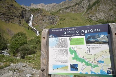
Le sentier glaciologique - Gouedard  Glacier
Glacier Trail
Take in the valley’s true magnificence from the Palet Pass, which provides you with views of some of the massif’s highest glaciers, with eight numbered marker posts located along the trail by the Vanoise National Park.
The itinerary, which takes around 4 hours to complete, was created and waymarked by the Vanoise National Park. The accompanying booklet contains all the information you might need as you get better acquainted with mountain glaciers.
On the itinerary: the Glière mountain hut (restaurant service and beds for the night), the high mountain pastures of the Plan du Sel and the secrets of Beaufort cheese production, and above all, no end of marmots!
You can get a copy of the booklet at the Laisonnay Reception and Information Point.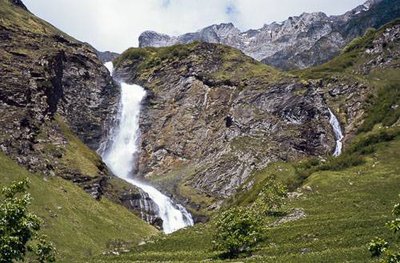
Cascade du Py, Champagny le Haut, commune de Champagny en Vanoise. - PNV - GOTTI Christophe  Water
WaterThe Py Waterfall
What could be more refreshing than starting your hike under the spray of the Py waterfall standing at 80m high! Ÿou will follow the mountain stream of the same name throughout the whole ascent towards the “Refuge de Plaisance”. In the mountains the variations in stream flow are impressive! In spring, the meltwater hurtles down the slopes at full speed while in the autumn the water subsides. The colour of the water can also change: a violent thunderstorm can quickly turn this clear water into black mud. A hundred years ago, it was still possible to pass between the waterfall and the wall without getting wet! This is unthinkable today, which just gœs to show how strong the eroding Py stream is.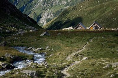
Le Ruisseau du Py et le refuge PNV de Plaisance. - PNV - FOLLIET Patrick  Refuge
The Refuge de Plaisance
The two “Chaloin” chalets at the Refuge de Plaisance were built by Vanoise National Park. They have suffered the rigours of winter on two occasions: in February 1999, a remarkable avalanche pushed the bunkhouse chalet, which weighs about ten tons, against the building housing the dining room. In January 2004, the roof of the chalet was damaged by a storm. Life is hard for the mountain refuges in winter!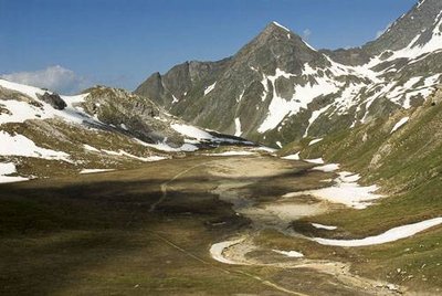
Le Plan Séry. Au fd., la Pointe des Chardes. Vue vers O. - PNV - GARNIER Alexandre  Flora
FloraPlan Séry and its flora
This lake now has more water and what a sight! This vast expanse appears to be an ancient dried glacial lake. If you take the time to look more closely, you might find the carex bicolor, a small protected plant. This small grass can be recognised by its small two-toned spikelets in pistachio and chocolate. Like all rare species in Vanoise, Park agents map it to assess its presence within the territory. It is much less spectacular than the edelweiss that you can admire all around the lake. Even if this species is not protected contrary to popular belief, do not pick it! Flower picking is strictly prohibited in the heart of the Park especially because other hikers should be able to admire the snow stars.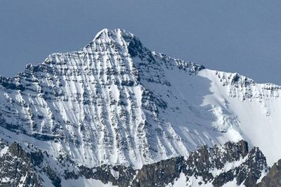
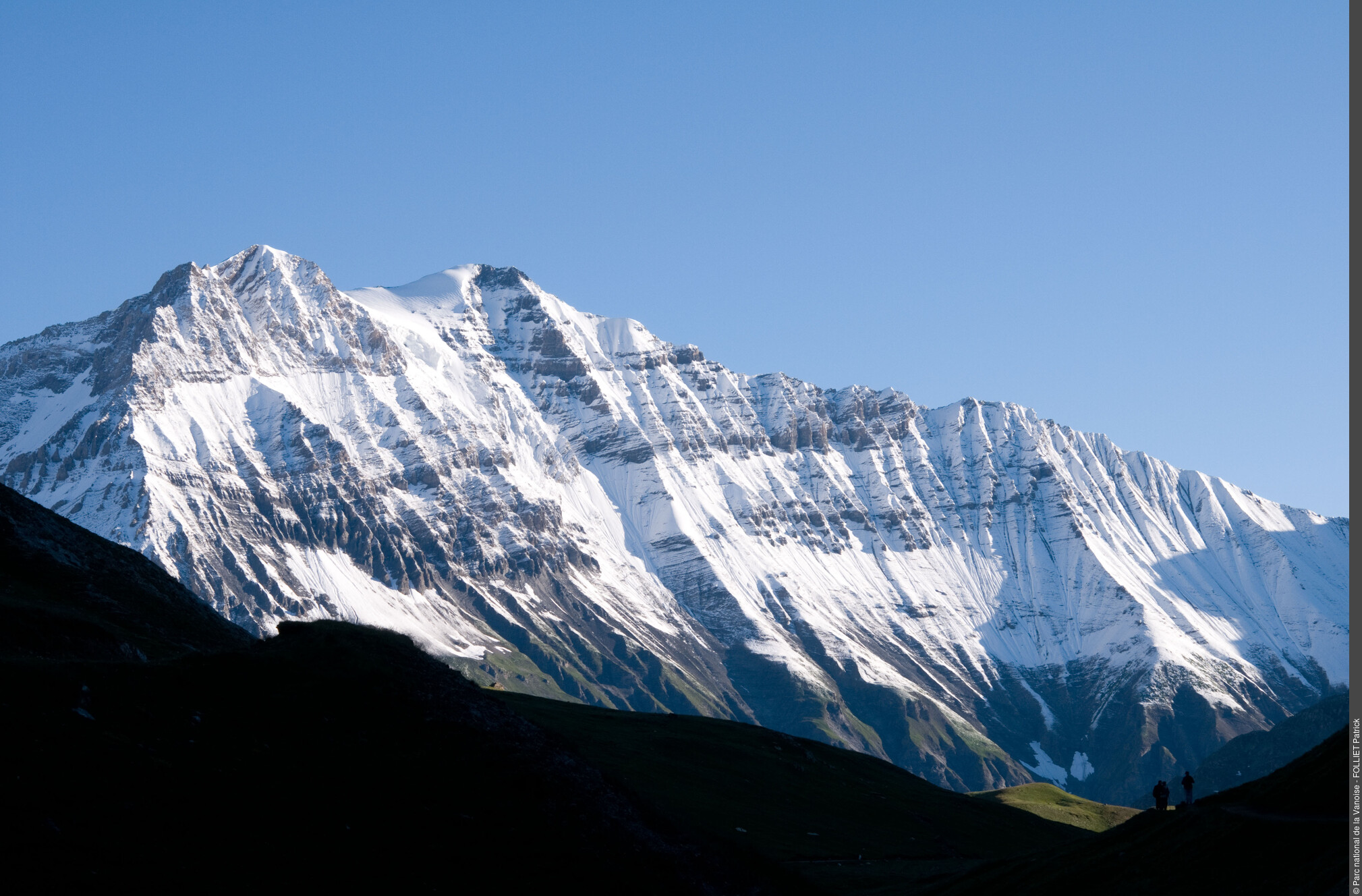
Vue panoramique de la Grande Casse, face N. Commune de Champagny en Vanoise. - PNV - DELORME Michaël  Summit
The Grande Casse
From the Col de la Grassaz you can admire Vanoise’s highest summit, the Grande Casse standing at 3,855 m. The first ascent of the Grande Casse was made on 8th August 1860 by William Mathews, a British climber and his guides Michel Croz and Étienne Favre. But the impressive facing slope, with its hanging glacier, is the north face of the mountain and was much harder to climb. And so the first journey of the north-north-west face of the Grande Casse was made by Victor Puiseux and his son Pierre Puiseux, Amédée Crochet and Joseph Amiez.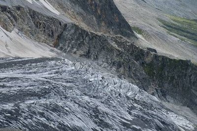
Le Glacier de l'Epéna. - PNV - GOTTI Christophe GlacierThe glaciers
On the left bank (downhill) of the Glière valley, there are about ten glaciers. They resist melting thanks to the shadow of the mountains looming over them. Here you can see the cirque glaciers (Becca Motta, Nord de la Glière), glaciers of the slope (Volnets, Troquairou), the valley (Epéna, Rosolin, Roche du Tougne), restored glaciers (Pramort) and the ice cap (Grande Motte). They cover a surface of 12 km2.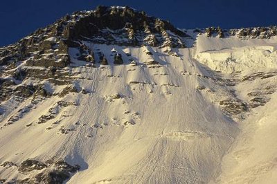
Face N de la Grande Casse. - PNV - GOTTI Christophe  History
Mountaineering
Unlike Pralognan-la-Vanoise, Champagny-en-Vanoise was very late to be visited by mountaineers. The high summits were first climbed by the easiest slope, from Pralognan (Grande Casse, Épéna and Grande Glière). Thus, the northern faces were only scaled later: the small northern face of the Grande Casse by the Puiseux brothers in 1887; the Couloir des Italiens in 1933 and the northern face of the Epéna in 1966. Other famous northern faces had to wait until the twentieth century to be scaled. Grandes Jorasses, Cervin and Eiger.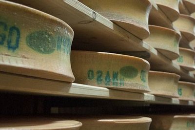
Meules de beaufort entreposées dans les locaux de stockage et d'affinage de la Coopérative laitière de Val Cenis. - PNV - NEUMULLER Christian  Pastoralism
Beaufort cheese
La Grande Plagne and its chalet of Plan du Sel is one of the places where the Beaufort d’Alpage is made. Raw whole milk, from tarentaise and abondance cows, is press-cooked, with at least 50% fat, moulded into a concave heel circle, before developing a natural crust which is strengthened by regular brushing. Each cheese weighs between 30 and 60 kg, with a diameter of 40 to 60 cm and a thickness of 12 to 16 cm. The Protected Designation of Origin imposes undeniable constraints, such as the obligation to manufacture cheese with the milk of a single herd twice a day. But it also ensures that quality farming in the high mountains is maintained which is essential to sustaining the Vanoise landscapes...and, in addition, is pleasing to the palate since this cheese is delicious!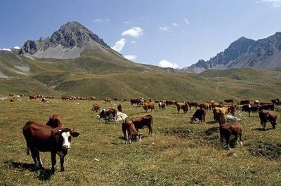
Troupeau de vaches de races Tarentaise et Abondance. - PNV - GARNIER Alexandre PastoralismThe mountain pasture of Grande Plagne
The alpine farmers lead the cows every year on to the mountain pastures of the Grande Plagne. At the chalet of Plan du Salt (2,250 m), the milk of the tarentaise and abondance cows (the only breeds authorised under the Beaufort PDO) is transformed into Beaufort d´Alpage over 100 days. The weak spot of this mountain pasture is the water resource. During periods of drought, the alpine farmer must obtain supplies downstream from the Refuge de la Glière, and pay for a number of trips to take up one tonne of water to the chalet.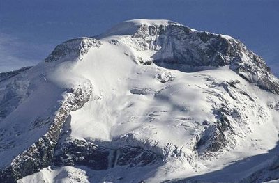
La Grande Motte, Champagny en Vanoise. - PNV - BENOÎT Philippe GlacierThe Grande Motte (3,653m)
A magnificent glacial dome, visible from the valley of Champagny le Haut, the Grande Motte looms over the ski resort of Tignes. The Grande Motte cable car (3,450 m) serves the glacier of the same name, still used for summer skiing. This cable car’s pylon, visible along the length of the hike, is located in the municipal territory of Champagny-en-Vanoise. The STGM (Compagnie des Téléphériques de la Grande Motte) pays a fee each year to the town of Champagny-en-Vanoise.