
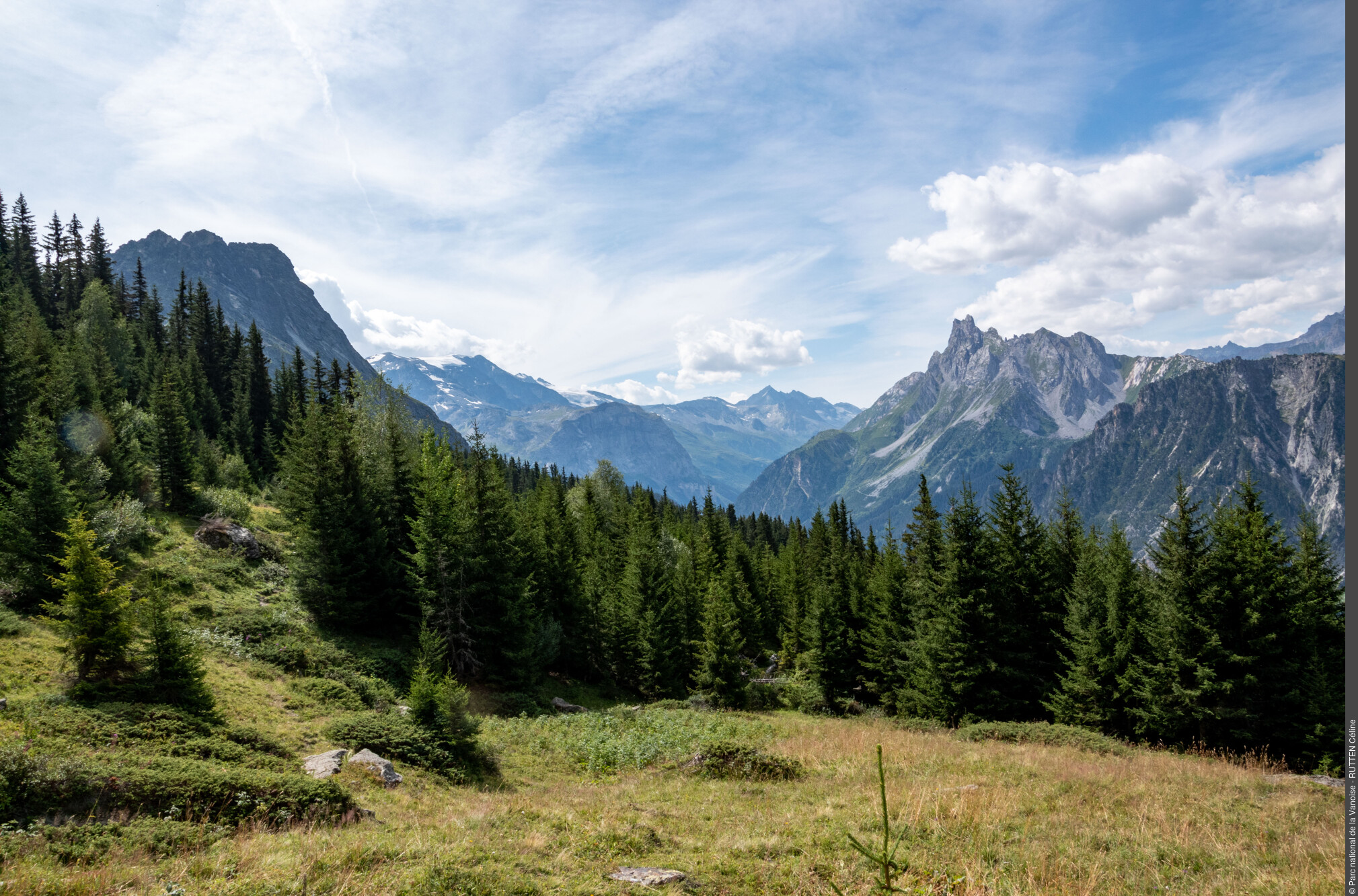
The montagnettes of Planay
On this entirely sloping landscape, the mountain dweller had to adapt to the conditions. His way of life was born from the slope. At the return of summer, the herds left the bottom of the valley and headed back to the mountain pastures. A specific date was adopted, around Saint John. While waiting for the inevitable date, for the grass to grow at altitude, the cows are found at an intermediate bearing. They took their first step midway between the lower stables and those at altitude, in what are called the montagnettes. This relocation was called a “remue” (transhumance or summer quarters) From the French verb “remuer”, meaning to relocate In Planay, they are called “tramoués” in patois.
Description
From the car park, go up to the left of the houses by a small path which crosses the road upstream of the houses, which then crosses north towards the hamlet of Mollard (1,564 m in altitude). Take the trail lined with a dry stone wall that rises above the winding road. Continue straight ahead at the boundary marker, joining an EDF track further up that leads to Pélapoët. Follow this track to the left until you reach the barn (1,614 m in altitude). Take the trail that rises to the Chalet de la Golle. Immediately upstream, leave the trail for the Tour du Merle, turning directly onto a track on the right which descends just before going up to the hamlet of Plan Fournier (1,723 m in altitude). Cross the hamlet, go up the road for a few dozen metres and take the trail on the left at a cross. This trail rises slightly up to a crossroads. Turn left onto the ascending path which plunges into the spruce forest and head north first, then go back south, slightly horizontally at first, to reach the top of the steepest part. Cross the clearing, then the forest that follows it. Then a succession of clearings leads to the Cave de Plan Fournier (or Plan Fournier Dessus) at 1,970 m in altitude. From the Cave de Plan Fournier, take the trail due south which rises towards the Gallinettes. Leave this trail after a hundred metres and go down to the right slightly after the grove. Go up a few dozen metres, still towards the south, and enter the spruce forest. The trail continues through the forest until it joins, at a near-level altitude, the Bois Blanc. At the crossroads, take the trail on the right leading down to the car park (1,805 m in altitude) of the Refuge du Grand Bec track. Go down the track as far as Plan Fournier. Cross the hamlet, but do not take the track used for the ascent. Take a small path downstream, which gœs straight down through the forest, to the Maison de Pélapoët, then again head straight as far as Mollard, where you will find the ascending path leading back to La Rochette.
- Departure : La Rochette (alt. 1,500 m)
- Arrival : La Rochette (1,500 m in altitude)
- Towns crossed : PLANAY
Forecast
Altimetric profile
Recommandations
This walk can be done in half a day. Please note that the climb and descent between La Rochette and Plan Fournier run for a good part along the theme trail ""Man and the slope"". It is interspersed with reading tables, providing valuable information on life in and around the mountains in times gone by.
"Information desks
Maison de la Vanoise, Avenue Chasseforêt, 73710 Pralognan-la-Vanoise
290 avenue de Chasseforêt, 73710 Pralognan-la-Vanoise
Transport
Access and parking
Following the road from Bozel to Pralognan, head to Planay-en-Vanoise. Take the direction of Pralognan (D915), which you leave after 600m by turning left to reach the listed hamlet of Chambéranger. At the entrance to the village, turn right on to the narrow road that leads to La Rochette (1,500m), and park.
Parking :
More information
7 points of interest
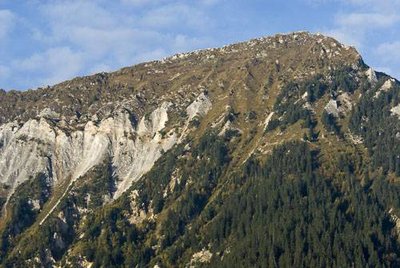
La Dent du Villard, Planay. - PNV - GARNIER Alexandre  Geology
The Dent du Villard
From the pylon near the car park, admire the mountain standing before you. This is the Dent du Villard. Its ridge is remarkable for its gentle profile, its constituent uniform white-coloured rocks, its very particularly detailed relief, deeply ravined on on its side and lunar on its crest with deep depressions. These characteristics owe to the fact that this mountain is made up almost exclusively of Triassic gypsum.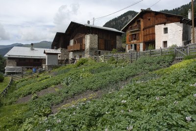
 Architecture
The hamlet of Mollard
Upon arriving under the hamlet of Le Mollard, you are greeted with an attractive view of a hamlet with temporary housing, inhabited in the summer and winter by the mountain dwellers of times past. A spring, gardens, cowsheds, barns and coladz (building for storing fresh milk) served all the needs of everyday life over the changing seasons. Notice here the oratory of the Sacré-Cœur, attesting to the faith of the mountain dwellers. It came back to life after the long winter months, when the inhabitants prayed there once again to invoke the protection of the saints.
Canal d'irrigation des Galinettes. La Fontaine Froide, Planay. - PNV - GOTTI Christophe  Pastoralism
The cellars of Plan Fournier
Ÿou are at the foot of the Fontaine Froide pasture. This cellar has been transformed into a shelter for shepherds, hunters and hikers. Feel free to push open the door, but don’t forget to close it on the way out. This cellar was once used to store the cheeses produced during the summer, before they were taken down to the village. During that time, the family returned to the village to work in the fields and at haymaking.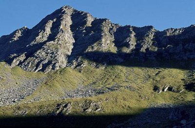
La Pointe de Méribel, Planay. - PNV - GOTTI Christophe  Summit
The Pointe de Méribel
"We are here at the foot of the western slope of the Pointe de Méribel (2,830 m in altitude). It dœsn’t owe its name to the ski resort located two valleys away! It is most likely named after the mountain of the same name located on the slope of Champagny. Méribel or Miri-bel means “beautiful look” or “beautiful view”. Think of the Latin “mirare”, which means to “admire”. This name was used to describe places which had a ""spectacular” view. To the north, the Rochers Rouges (2,250 m in altitude) are inhabited by the ibex and chamois who find protected and well exposed slopes there."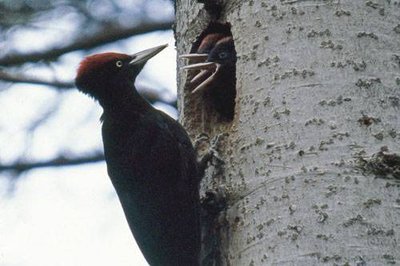
Pic noir. - PNV - MOLLARD Maurice  Fauna
FaunaThe Bois Blanc
The forest in which you stand is called a spruce forest. The spruce is the main tree in the mountain zones of Vanoise and is the dominant species of all the forest massifs of Planay. The spruce forest plantations bring together a great diversity of small passerine birds. Hence the European crested tit, the coal tit, the common redpoll, the goldcrest and the Eurasian bullfinch are the species typically found in this environment. With a strong, sharp beak, the woodpeckers vigorously strike the trunks of the trees in search of their food, consisting of xylophagous insects (wood-eating) and to hollow out their nests. They play a vital role for other forest animals who are unable to bore holes. Sit awhile under a tree and listen and observe; you may be lucky enough to hear or see a black woodpecker or a great spotted woodpecker.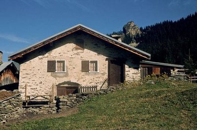
Maison du hameau de Plan Fournier, Planay. Vue sur la Tour du Merle. - PNV - GOTTI Christophe  History
The Plan Fournier
Each family climbed to settle on its montagnette towards the end of May. This hamlet was an intermediate step, both on the ascent and the descent, for the herds en route to the alpine pastures of Gallinettes, Fontaine Froide and Vuzelle. The meadows were grazed on by the animals as they ascended, then as they descended they grazed on the second growth called the regrowth. Plots were also mowed on the montagnettes. This intermediate pasture was often gained by deforestation and clearing. It remained there until 22nd June, the date of departure for the upper pasture where the cows remained all summer.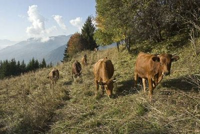
Vaches au pré près de Pelapoêt. Planay. - PNV - GARNIER Alexandre PastoralismThe descent to the village
The descent path is bordered by the remains of dry stone walls. This was a very important development for the inhabitants of Planay. At the beginning of October, men and animals returned to the village for the regrowth at the bottom of the valley. On All Saints´ Day, they would go back up to the montagnette for a period of three months. The animals were fed with the hay reaped on site. The return to the village was made in February. The date depended on the reserves of fodder. The lean years precipitated this return. The descent was made in thick snow. Before leaving, the father recited De Profundis (Out of the Depths) to preserve the animals during the return and to protect the house during their absence.